Vestmannaeyjar
Vestmannaeyjar (in English, the Westman Islands) is one of my very favourite places in Iceland – or actually anywhere. It is an archipelago of 15 islands and rock stacks, located just off the south coast of Iceland. There is a ferry crossing from Landeyjahöfn on the south coast that crosses over to the islands seven times a day and the crossing takes about 40 minutes.
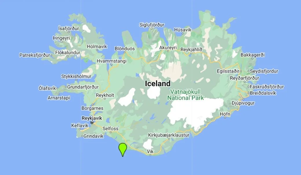
The view of Heimaey as you approach from the ferry
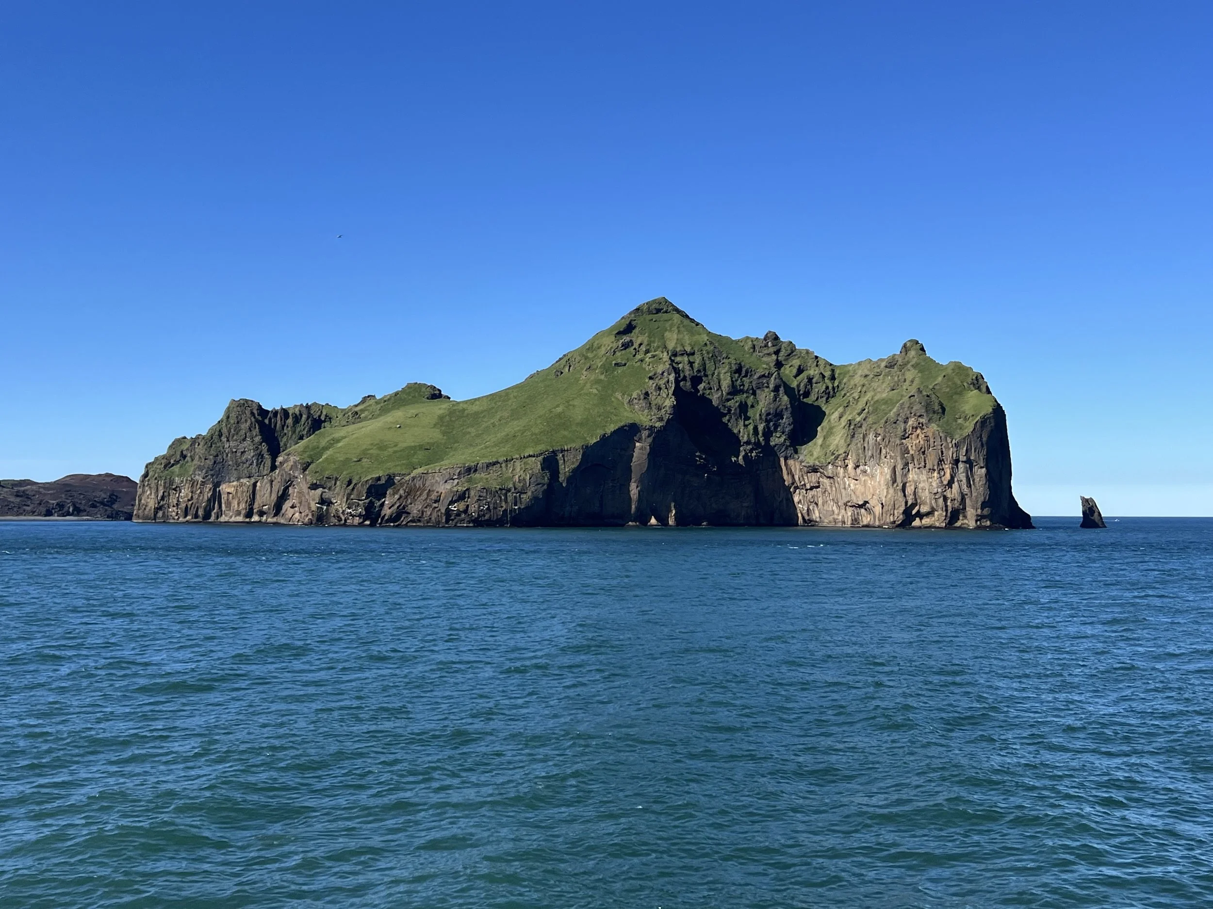
The islands were formed some 11,000 years ago, at least 14 of the 15 were… Surtsey Island, the youngest of them, emerged from the sea just 62 years ago in 1963! I have read that the crew of a ship that was passing Vestmannaeyjar saw smoke and thought that there was another ship on fire, so went closer to see if they could help. When they got nearer, they saw a new island rising from the ocean!! I can only imagine how amazed they must have been - what a thing to witness! It was formed due to a volcanic eruption that took place underwater from 1963 to 1967 and by the time the eruption finished, the island measured over 500m (1,640 ft) in length and 45m (147 ft) in height. It was named Surtsey after Surtr, a fire giant from Norse mythology. Surtsey has been protected since its birth, as biologists wanted to take this opportunity to create a pristine natural laboratory. They made the decision to keep the new island completely free from human interference, and to see how long it would take for plants and animals to appear on the island completely naturally, with no human help. As a result, Surtsey has been producing unique long-term information on the colonisation process of new land by plant and animal life. Since they began studying the island in 1964, scientists have observed the arrival of seeds carried by ocean currents, the appearance of moulds, bacteria and fungi, followed in 1965 by the first vascular plant, of which there were 10 species by the end of the first decade. By 2004, there were 60, together with 75 bryophytes, 71 lichens and 24 fungi. Eighty-nine species of birds have been recorded on Surtsey. The 141 hectare island is also home to 335 species of invertebrates. It is still forbidden to land on the island or to visit it and even the area of sea around it is protected so nobody can get too close and affect the ecosystem of this isolated environment.
A shot I managed to get from the plane when flying over Surtsey
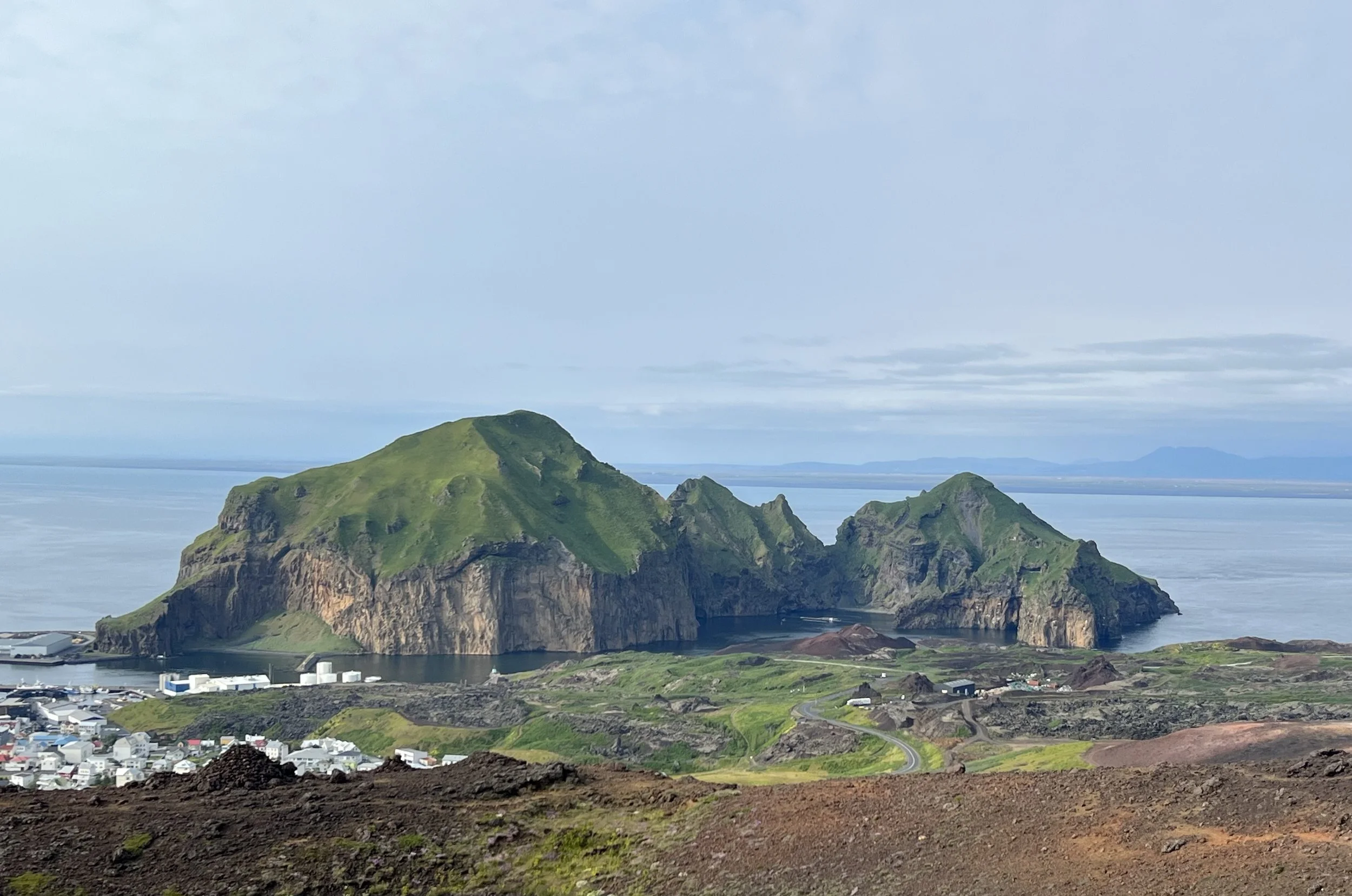
Of the other 14 islands/sea stacks, 13 are uninhabited. Heimaey (which means Home Island) is the biggest and the only inhabited island in Vestmannaeyjar so when people talk about visiting Vestmannaeyjar, it is Heimaey that they will actually be visiting, although it is possible to take a boat trip around Vestmannaeyjar and to get close to most of the other islands.
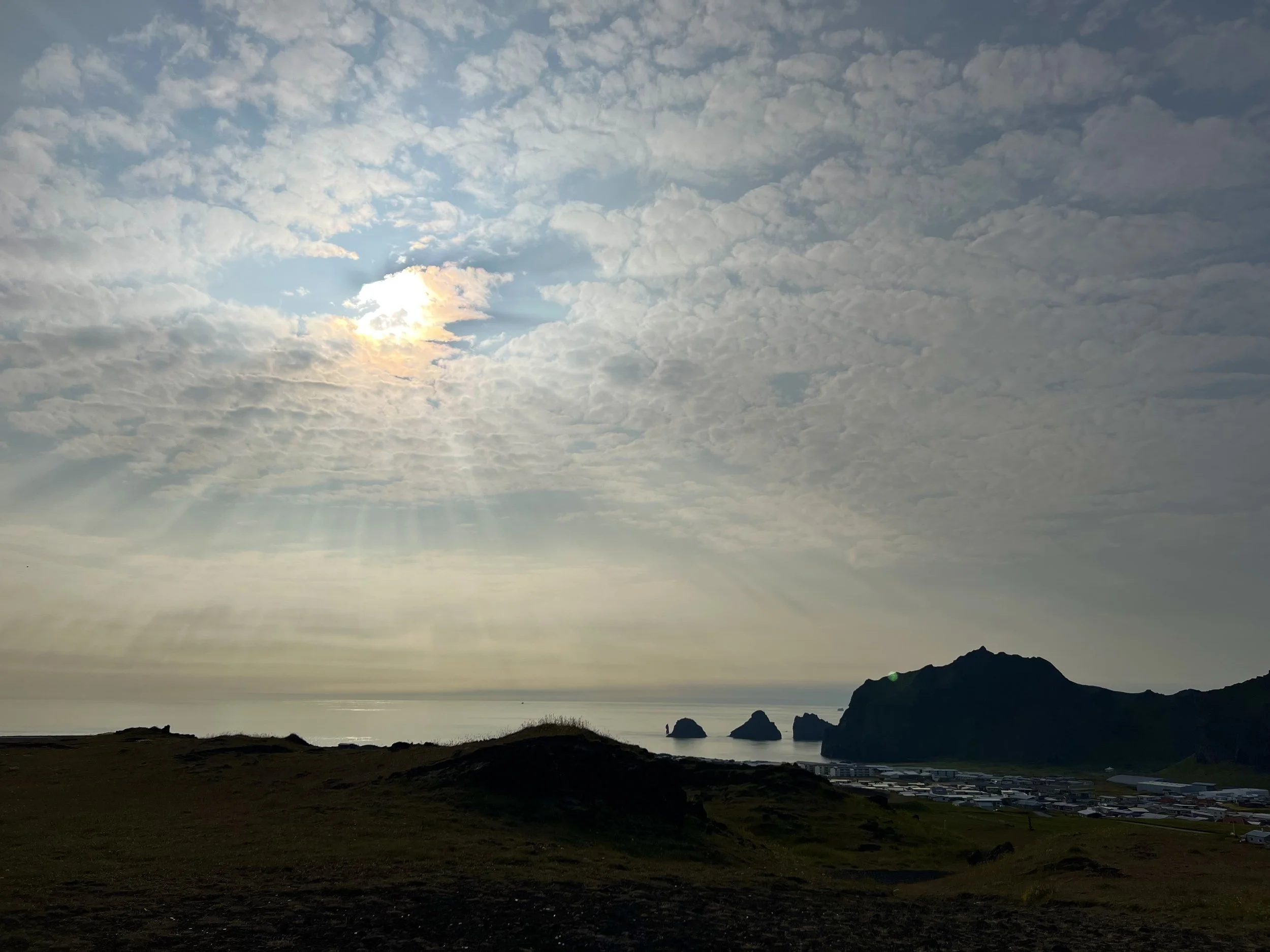
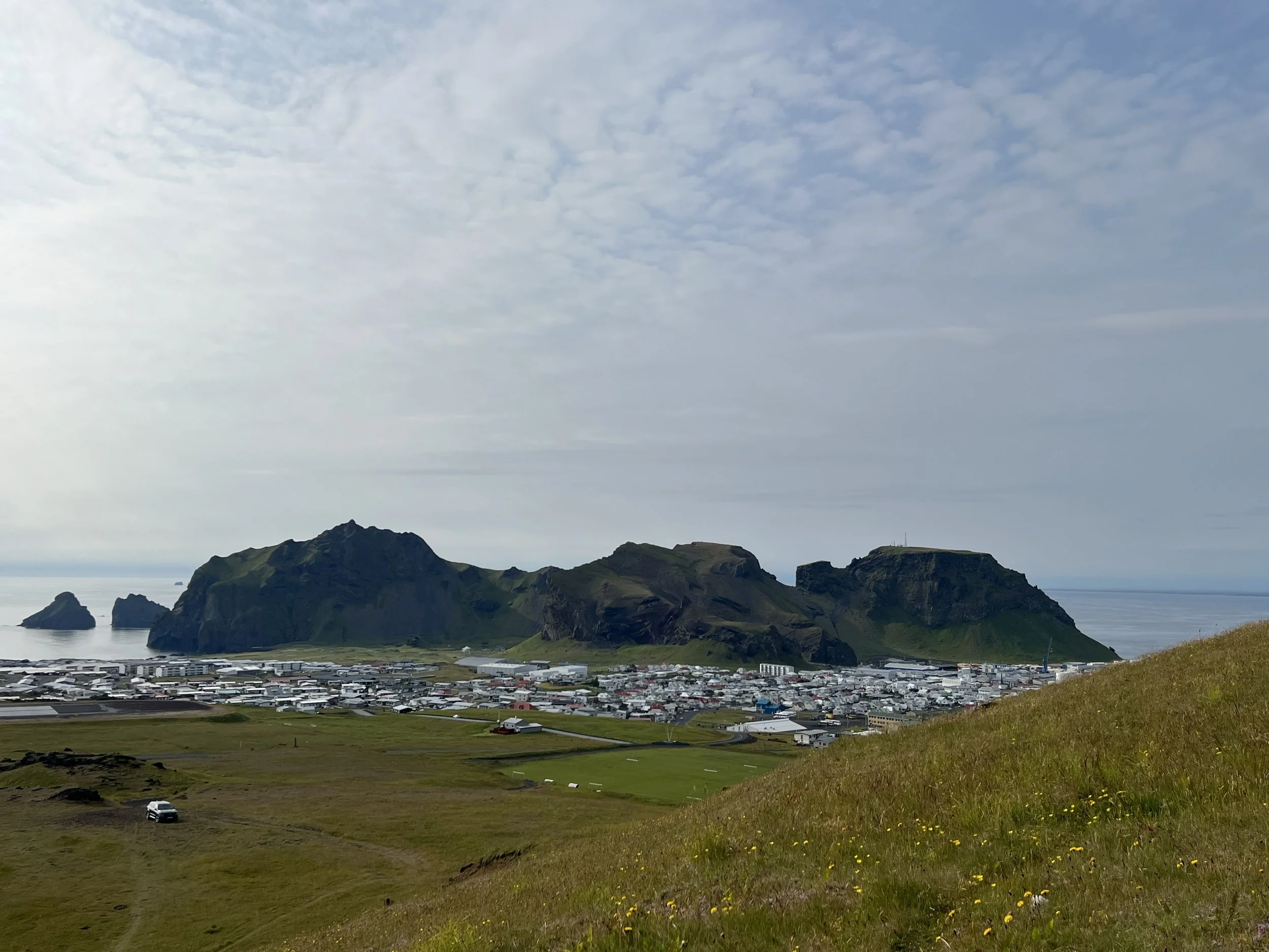
Heimaey is the biggest island off the Icelandic coastline and also one of the most beautiful. The scenery here is absolutely breathtaking, even from before you arrive. The sight of the island as you approach on the boat is incredible, and it just seems to get more beautiful the closer you get. If it’s a sunny day in the summer, the bright green of the islands, contrasts with the pitted, rocky cliffs and the almost turquoise sea… it’s just incredible. The first time (of many) that we made the trip over to Heimaey, we were even lucky enough to see whales and porpoises from the ferry, just to make the trip even more exciting!
Looking across the harbour approach
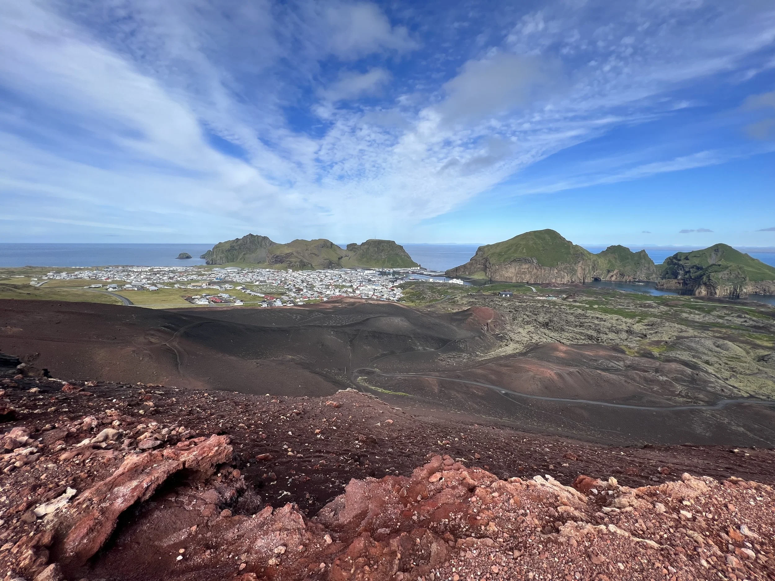
As we came into the harbour, we could see the bustling town revealed (there is only one town on Heimaey) with the two volcanoes in the background, dominating the landscape. It is the volcanoes, or particularly one of them, that is what makes Vestmannaeyjar so famous. The older of the two, Helgafell, has been here forever. It erupted some 5,000 years ago and is now dormant. However, the other one, Eldfell, erupted just over fifty years ago. Back then, Heimaey was a prosperous fishing town with some 5,300 inhabitants. One night in January 1973 it looked as if these 5,300 people were doomed when the dormant giant woke up and an eruption started just a few hundred metres from town.
The eruption of Eldfell
The Heimaey eruption started on January 23, 1973. A 1,600-meter long fissure opened up on the east side of the island, about 400 meters east of the outskirts of the town. During the first few hours the lava was forming illuminated fountains that were up to 150 metres (492 feet) high. The eruption lasted until June 26.
All in all, 417 houses had been destroyed by the lava and the rest of the town was covered with millions of tons of ash. as well as the houses that were buried, many other buildings were severely damaged. In all, approximately a third of the town was lost. Later the new mountain was named Eldfell, which means ‘Fire Mountain’.
The incredible thing is that by a combination of random factors, they were able to evacuate the entire island. Because there had been a big storm the previous day, the whole of the town’s fishing boat fleet lay in harbour. Just after the volcano erupted, one man who hadn’t been able to sleep, had decided to take his dog out in the early hours, saw the start of the eruption and raised the alarm. The island’s inhabitants were gathered in the harbour and loaded onto the boats, hospital patients were taken by air and only about 200-300 key personnel engaged in essential services stayed on the island. People had to abandon their homes without knowing whether they would ever see them again. Very few had managed to take anything with them and no one knew when they would be able to go back. Some never did. The mission to save Heimaey was nothing short of heroic. The fire fighters (and the island’s one plumber) stayed on the island, setting up dozens of fire hoses which they used to spray huge jets of seawater from the harbour onto the flowing molten lava in an attempt to slow it down and stop it from engulfing the entire town. Incredibly, it worked and you can see the point that the lava field reached, just short of the harbour. Even more incredibly, the result of the new land formed by the lava flow was to make Heimaey harbour more sheltered and therefore safer once the flow had cooled.
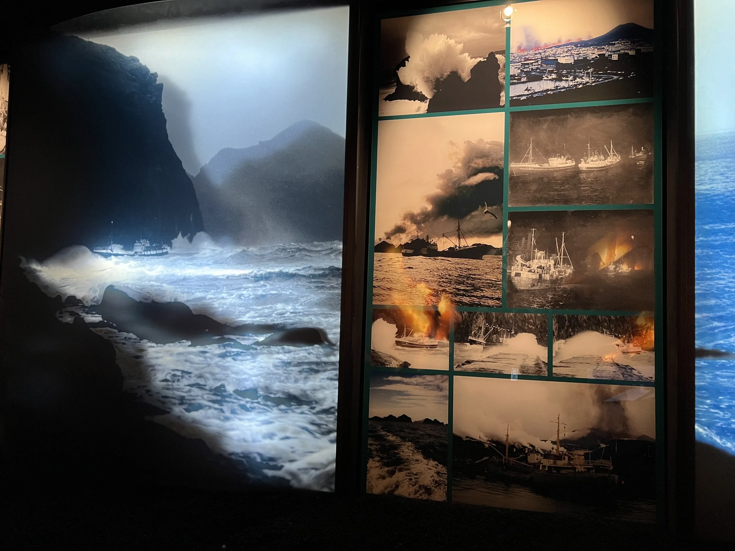
Some photographs taken at the time of the eruption - on display in the Volcano Museum
Although by the time the eruption finally stopped, some people had made new lives on the mainland, many of them returned to Heimaey and the whole island came together to build new homes and repair damaged ones. Years later, Heimaey is still one of the main fishing towns in Iceland, but the landscape has changed dramatically. Not only is there now a second volcano dominating the skyline, but there are the huge lava fields that run all the way down to the harbour itself. It’s quite sobering to walk up over the lava fields as there are street signs that have been erected to show where the old streets were, buried under the lava flow, and also many people have put up plaques to mark where their homes lay. This whole area is now very beautiful as the lava is covered in moss and there has been a great deal of planting, creating a natural haven filled with birdsong. It is simultaneously uplifting and very sad to walk through this beautiful place that was once people’s homes.
Stórhöfði and the puffins
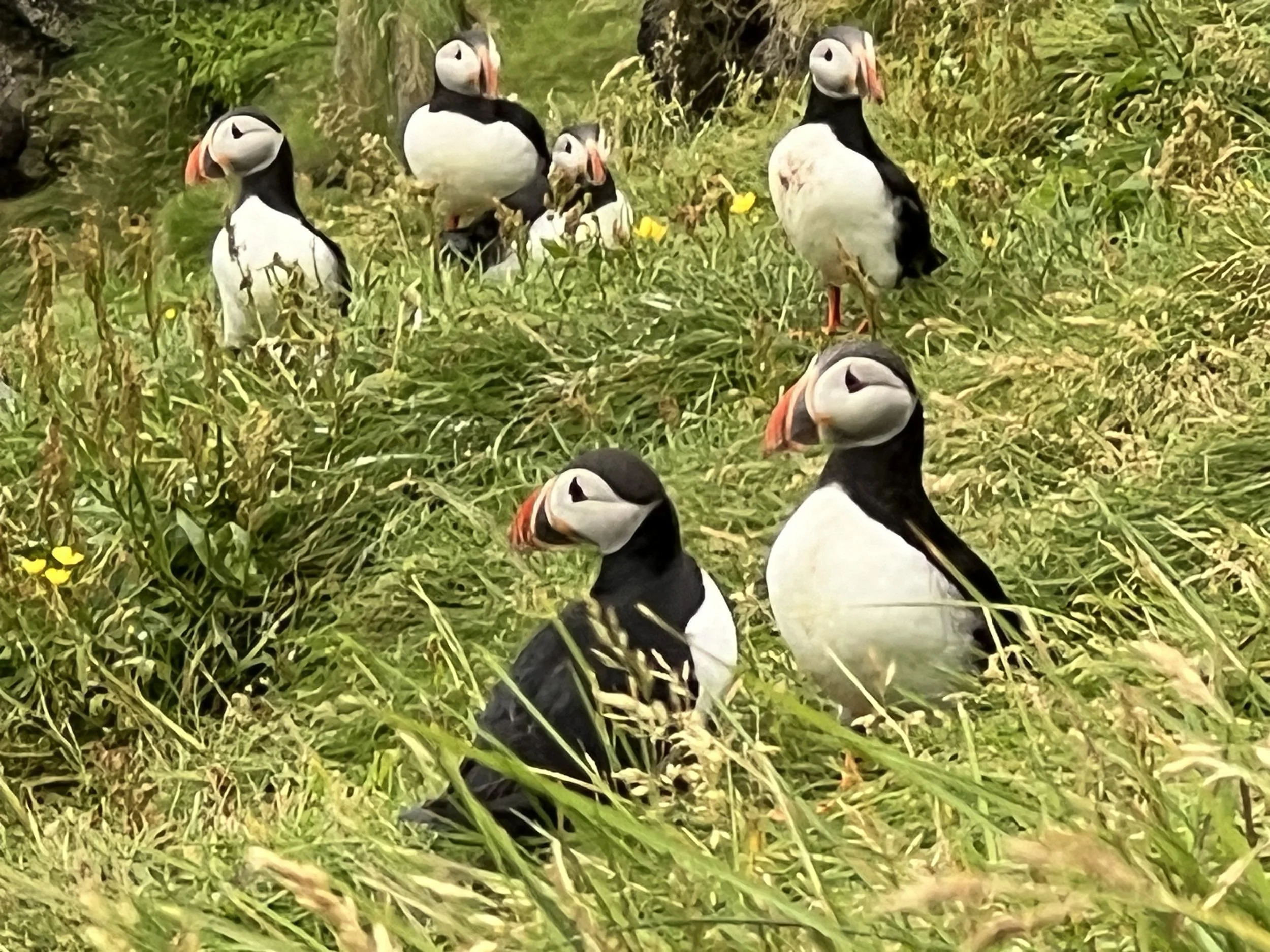
Of course, the other thing that Vestmannaeyjar is famous for is the puffins. Vestmannaeyjar houses the biggest puffin colony in the world and it is well worth going in the summer to see them. It is an 11km round trip to walk to the area where they are nesting, from the harbour. This can easily be done on foot as it’s a very easy walk along the side of the road to the other end of the island. On the ferry over to Vestmannæyjar you can either come with a car or by foot. It’s obviously much cheaper to go by foot but you do then need to walk everywhere (or get taxis/tours) once on the island. Heimaey isn’t big and to walk from the harbour to Stórhöfði (Great Cape) at the opposite, southernmost end of the island (where the puffins are) it is about 5.5km, so takes about an hour each way by foot, perhaps just under. I usually go there on foot, so have got quite used to the walk to Stórhöfði and will sometimes forego the road and walk the cliff path which is very beautiful but a much much longer walk. Once there, there is a green painted hut or ‘hide’ on the hillside where you can watch the puffins from within its shelter, but equally you can just sit on the tufted grassy hillside and watch them flying in and out of the burrows that are everywhere on the slopes.
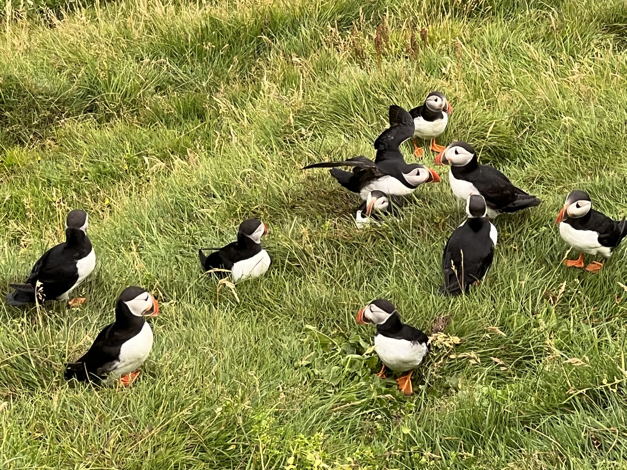
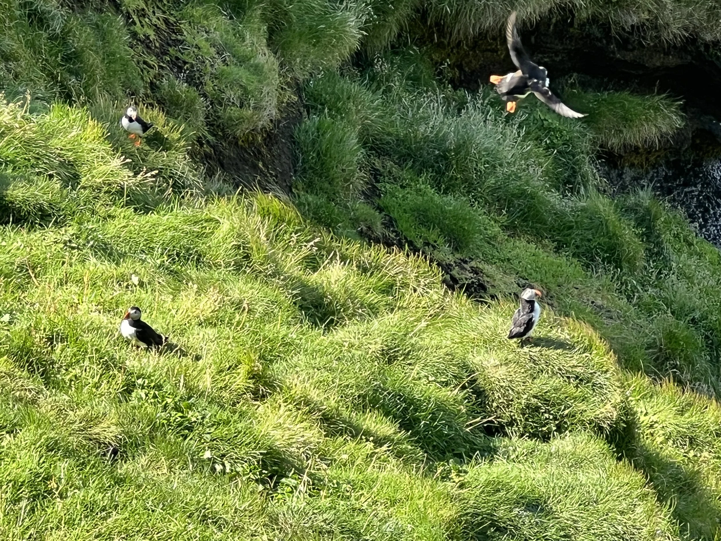
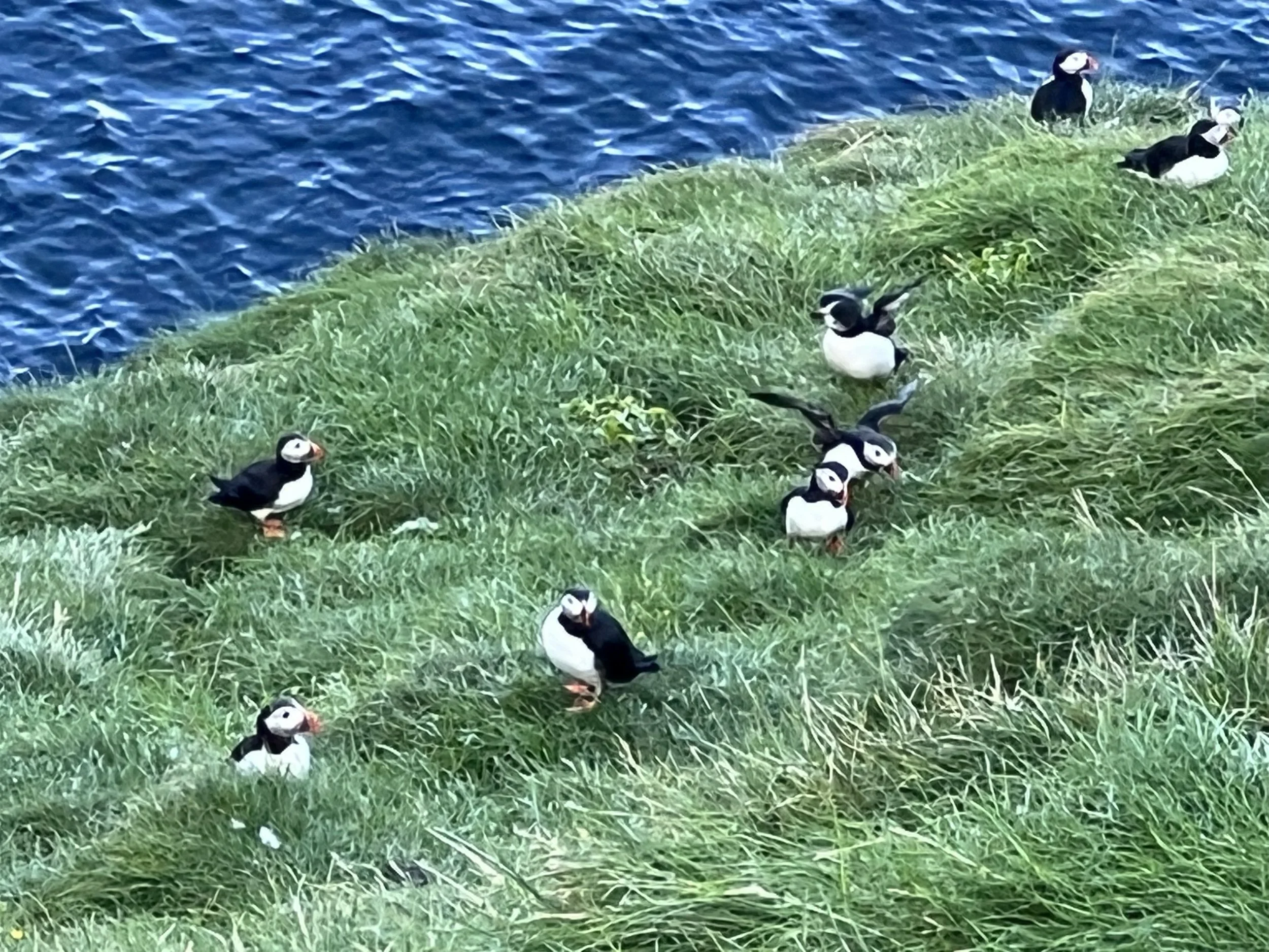
At any one time there are hundreds or even thousands of these funny little birds in view so it’s possible to spend hours there just watching and taking photographs. The optimum time of the year to see them is from the beginning of May through to August, and I was advised that early in the morning or later in the evening is the best time of the day. Having said that, there are still plenty of puffins to be seen throughout the day. Stórhöfði is also supposed to be the windiest place in Europe, so it’s worth being well wrapped up, even if the weather is good!
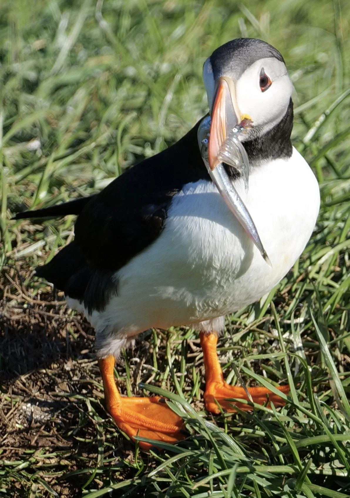
The local children of the Vestmannaeyjar islands have a very important tradition connected to the puffins. This is the ‘Puffling Patrol’! Every August and September, they come to the aid of lost baby puffins. In autumn, when it’s starting to get dark, the young puffins (known as pufflings) who’ve up until then been fed and cared for by their parents, start leaving their nests. The problem is, that instead of going to the sea like they are supposed to do, many of them can easily get blown off course, or the lights from the village attract them and they end up lost in the town, often landing on the streets, where they can easily get run over by cars or attacked by cats. However, the Puffling Patrol is there to help! In the evening, the locals, particularly the children, go around with cardboard boxes and collect up any lost baby puffins. It’s not uncommon for each child to collect 4 -10 pufflings each. They sleep in their temporary homes in the boxes overnight, but early in the morning, it’s time to help the young puffins to get to the sea, their original destination. They are taken to the beach well away from the harbour, which would be a very dangerous place to release the pufflings, and one by one, they are thrown out to the sea so they can fly to freedom. The throw has to be quite strong, as the young birds still don’t have much power in their small wings. Then they will stay in the sea by the coast until they can fly further away to spend the winter out on the open ocean. Any pufflings that are found which need first aid or any extra care get taken to the Sea Life Centre (see below) where they are weighed, assessed and looked after at the puffin hospital until well enough to be released.
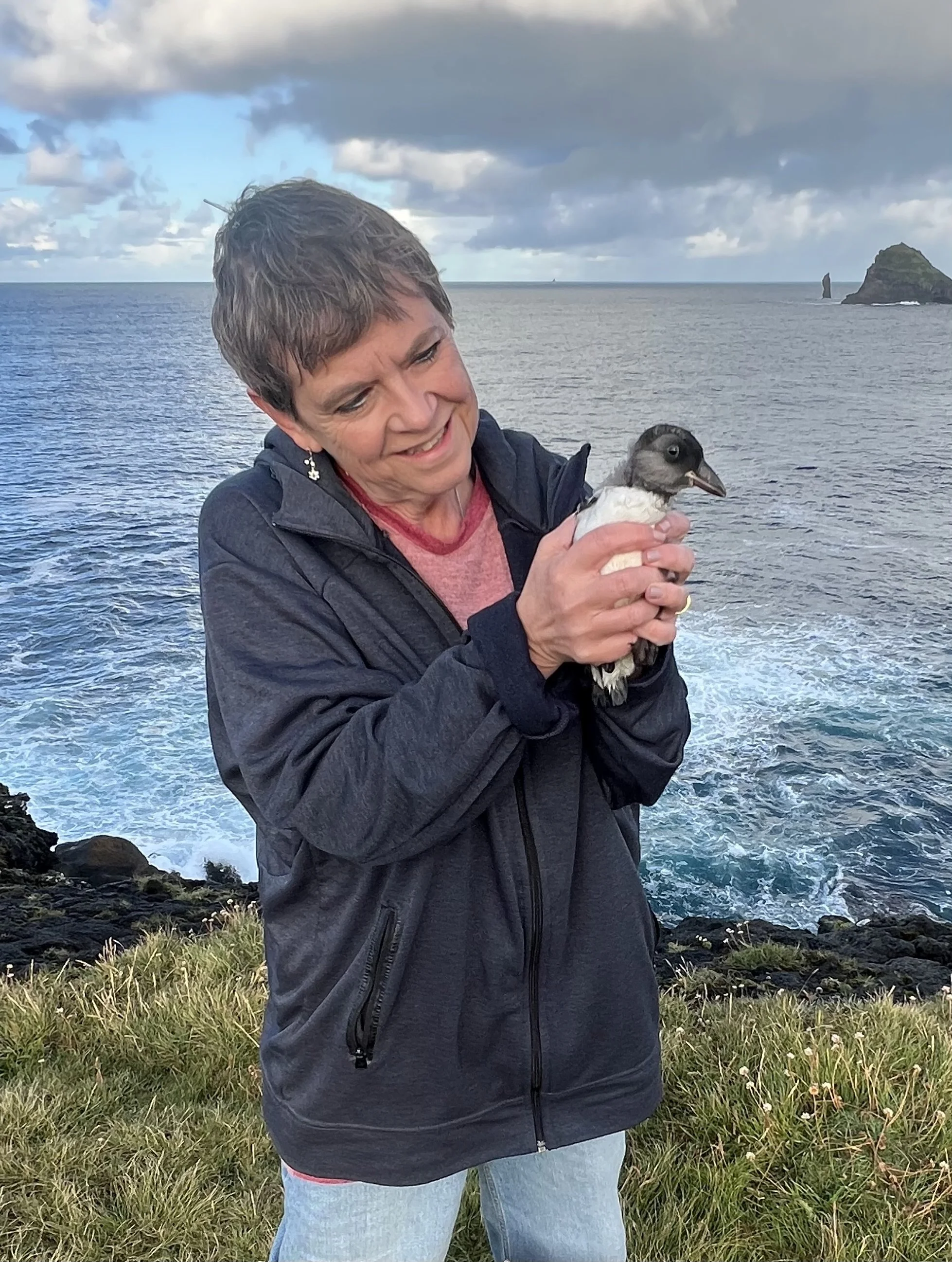
The day I got to join the Puffling Patrol
The reason that it is so important to find a good and safe place to release the pufflings, far away from the town and the harbour, is that an adult puffin will always return to the same place as it was released as a puffling. Therefore, most are taken to the beaches around Stórhöfði so that they can then return and settle into the existing puffin colony. Once I heard about it I was dying to get involved (and to actually get to hold one of these cute little birds!) and at last in September I finally got the chance (see my blog post of September 6th 2025, The day I joined Vestmannaeyjar´s Puffling Patrol).
Boat trips
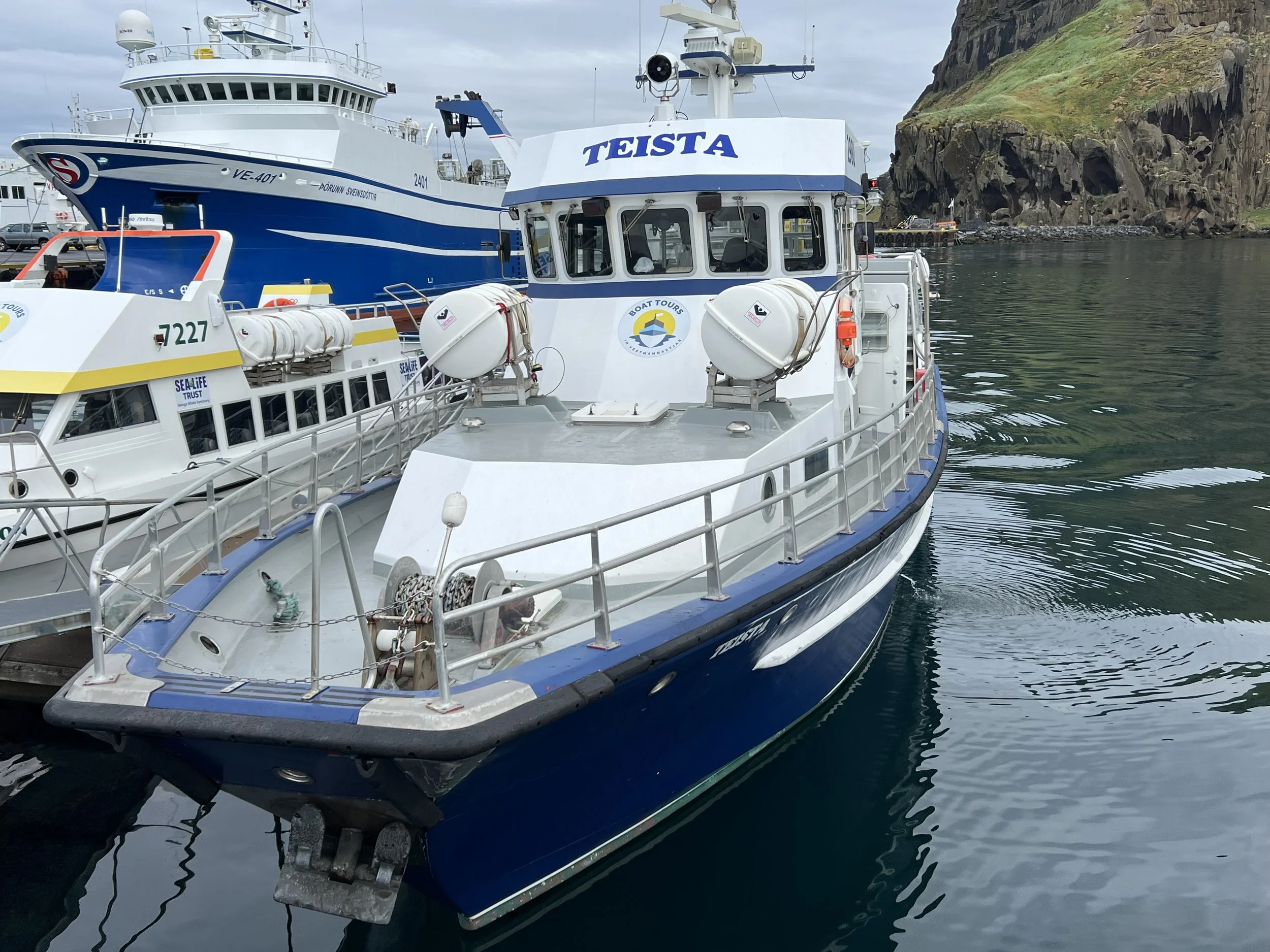
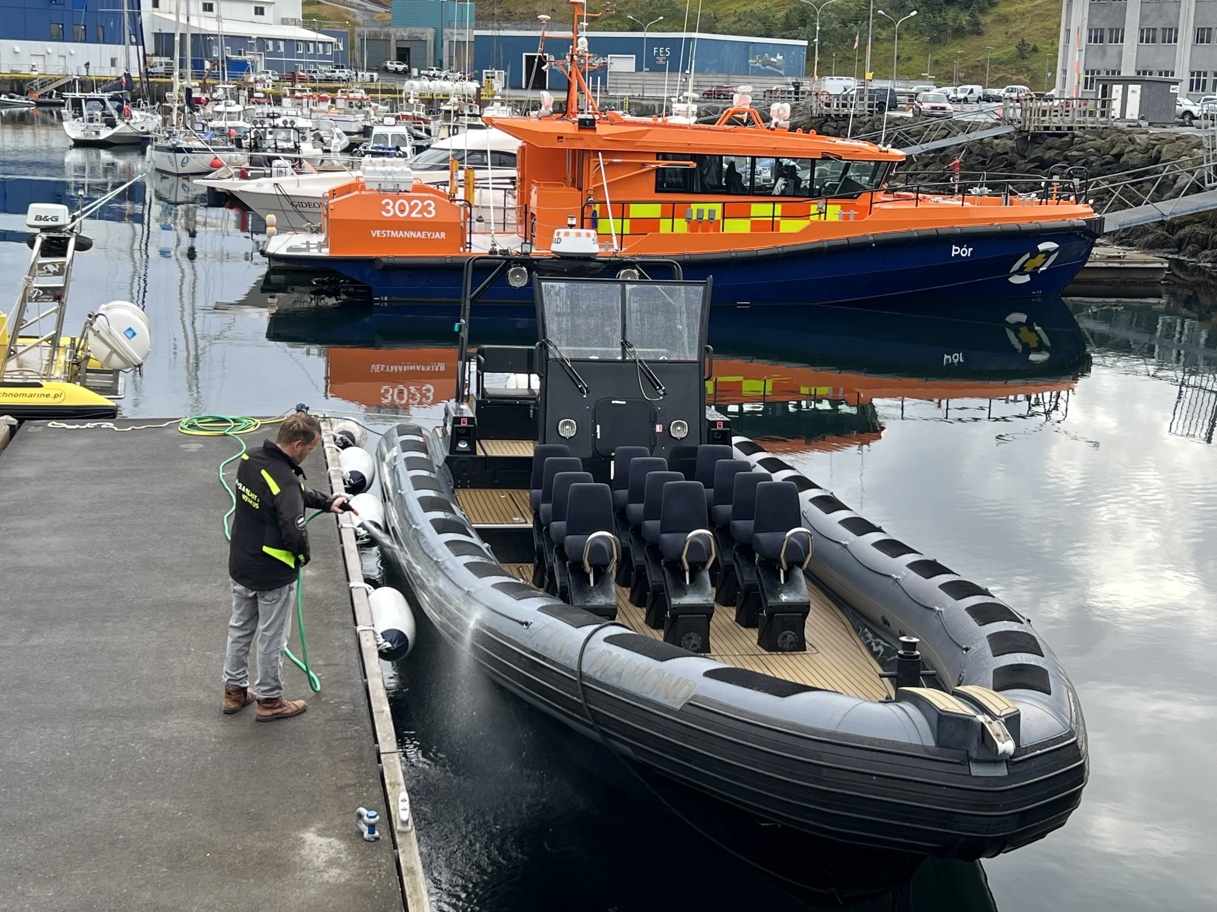
Two of the options for boat trips - the passenger boat Teista and the inflatable rib
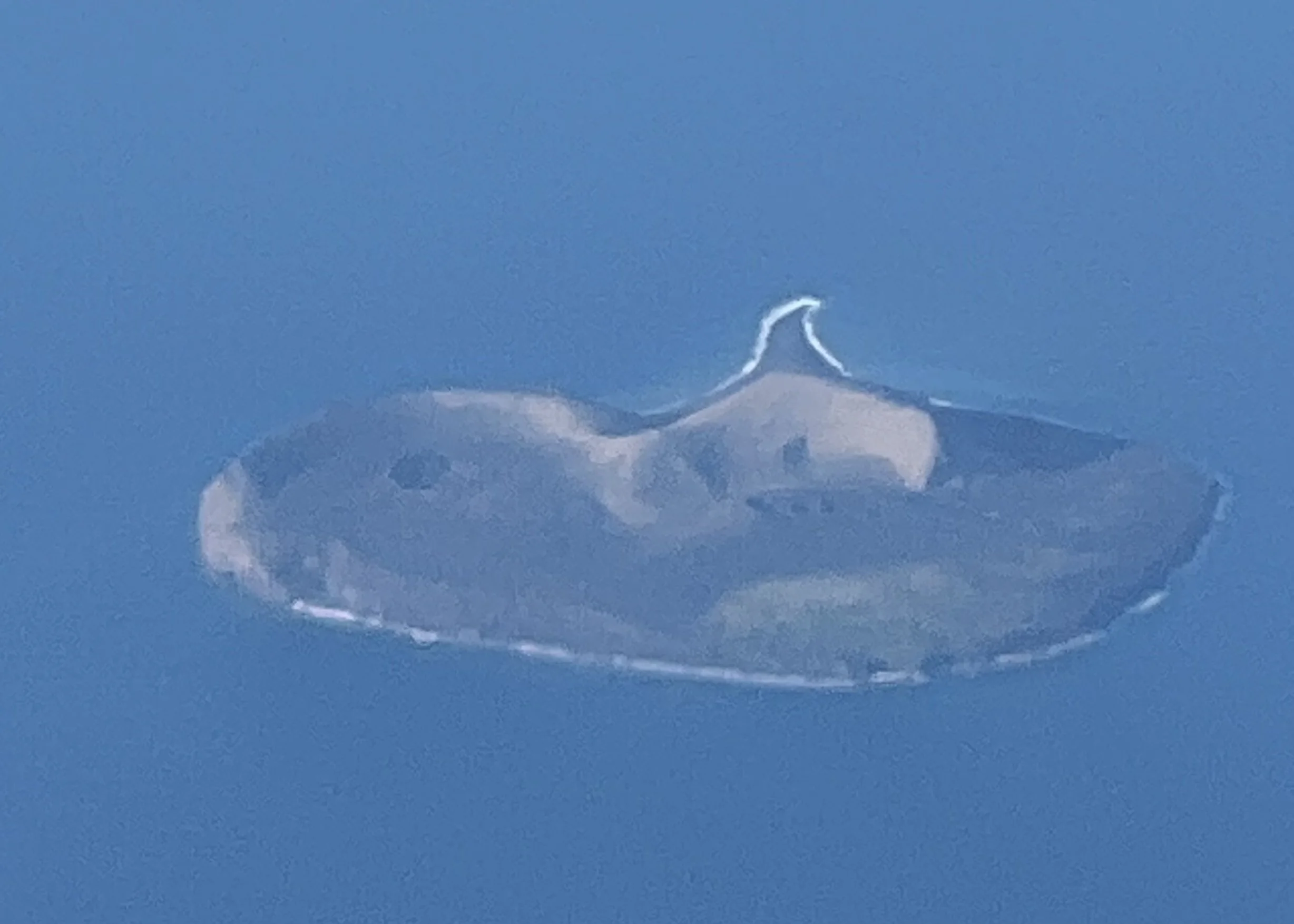
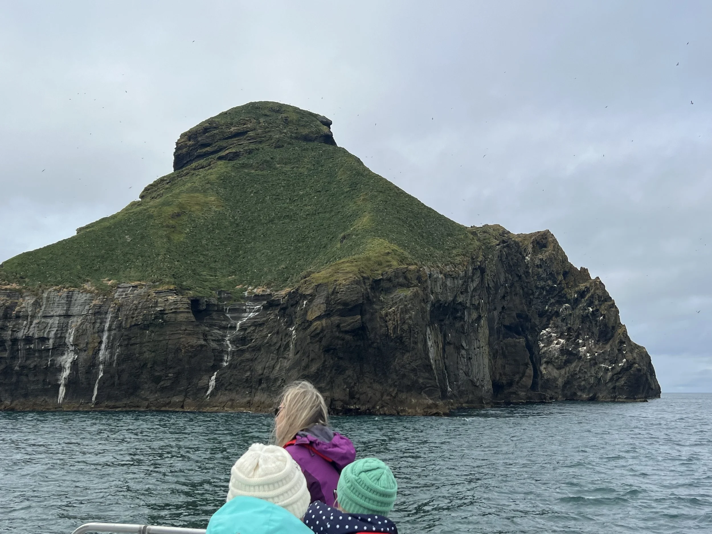
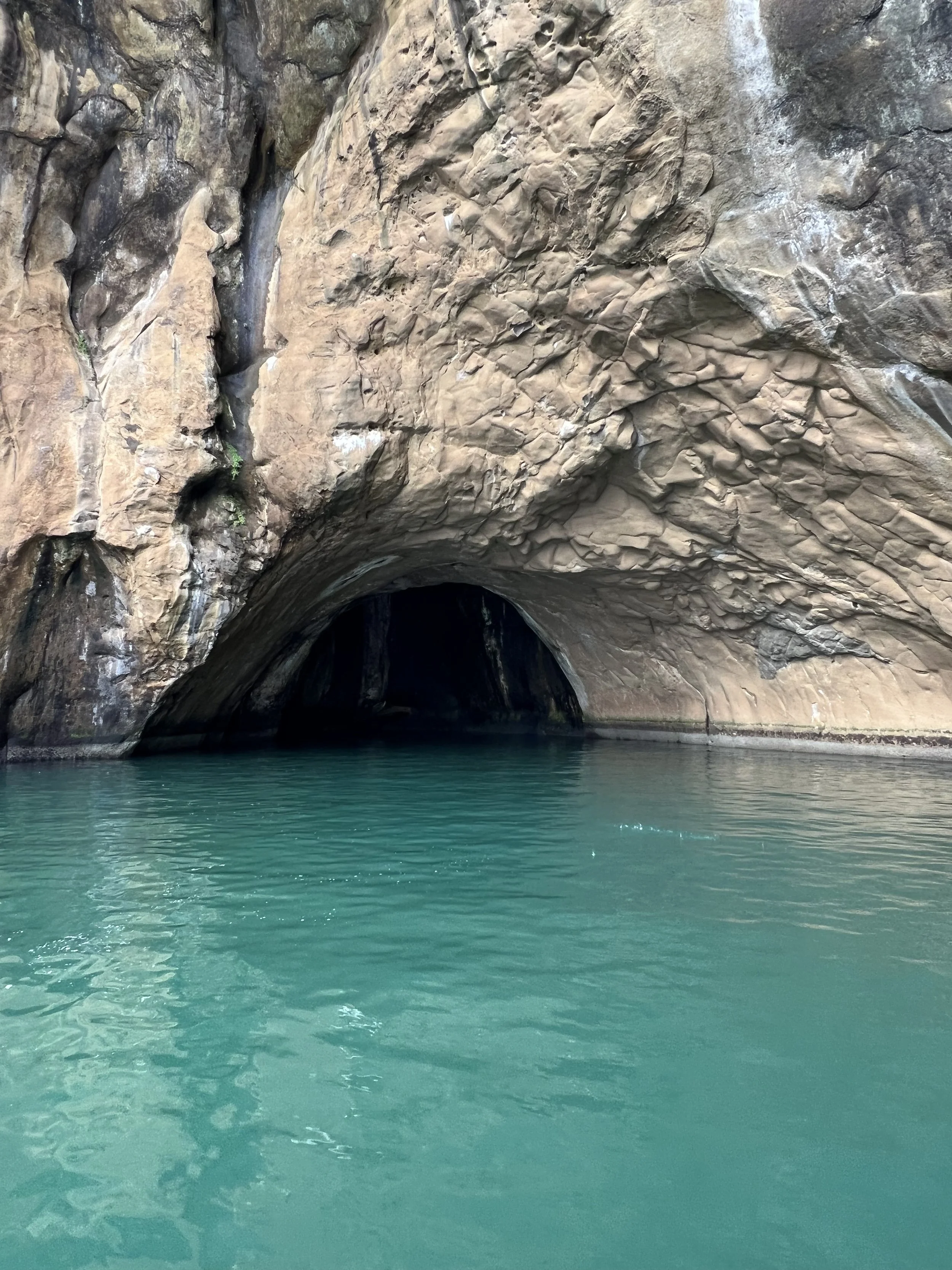
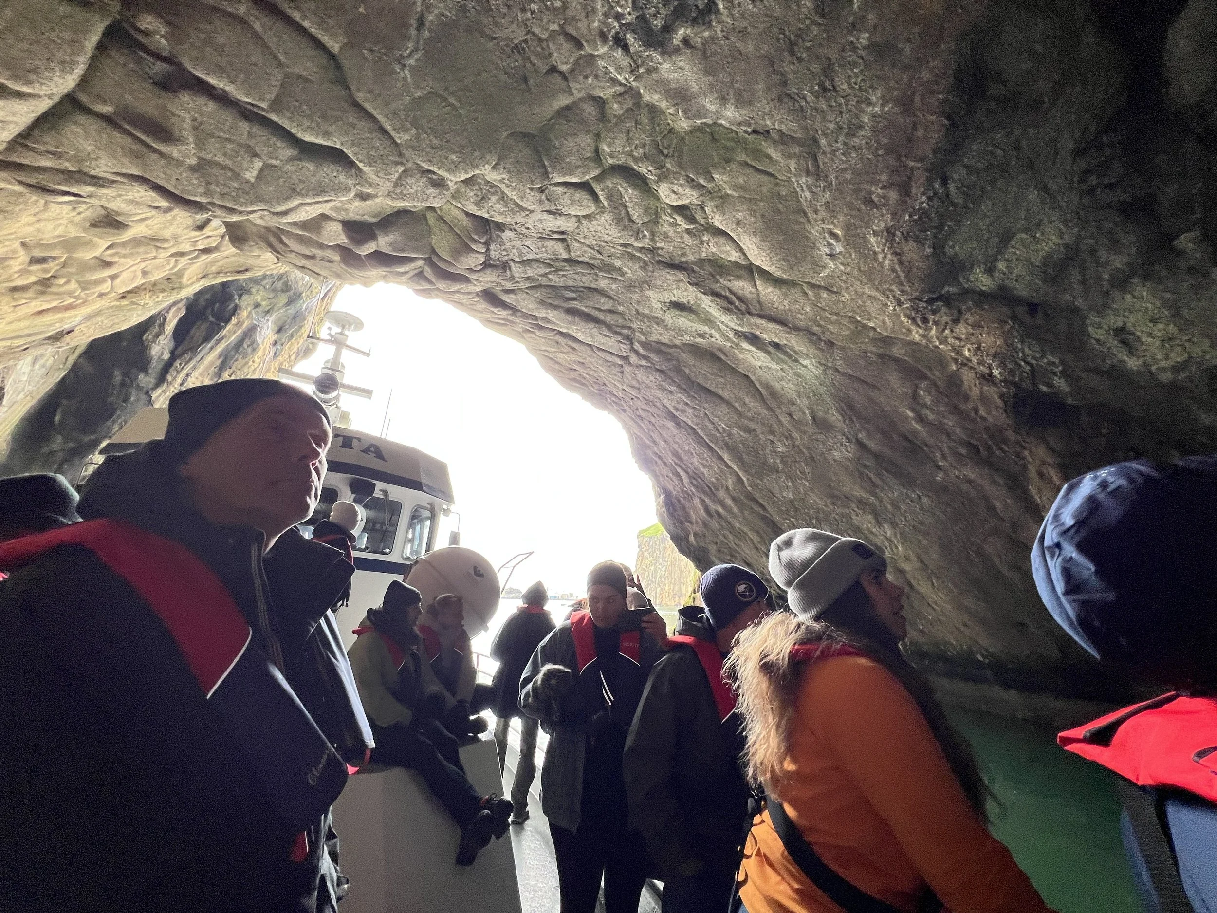
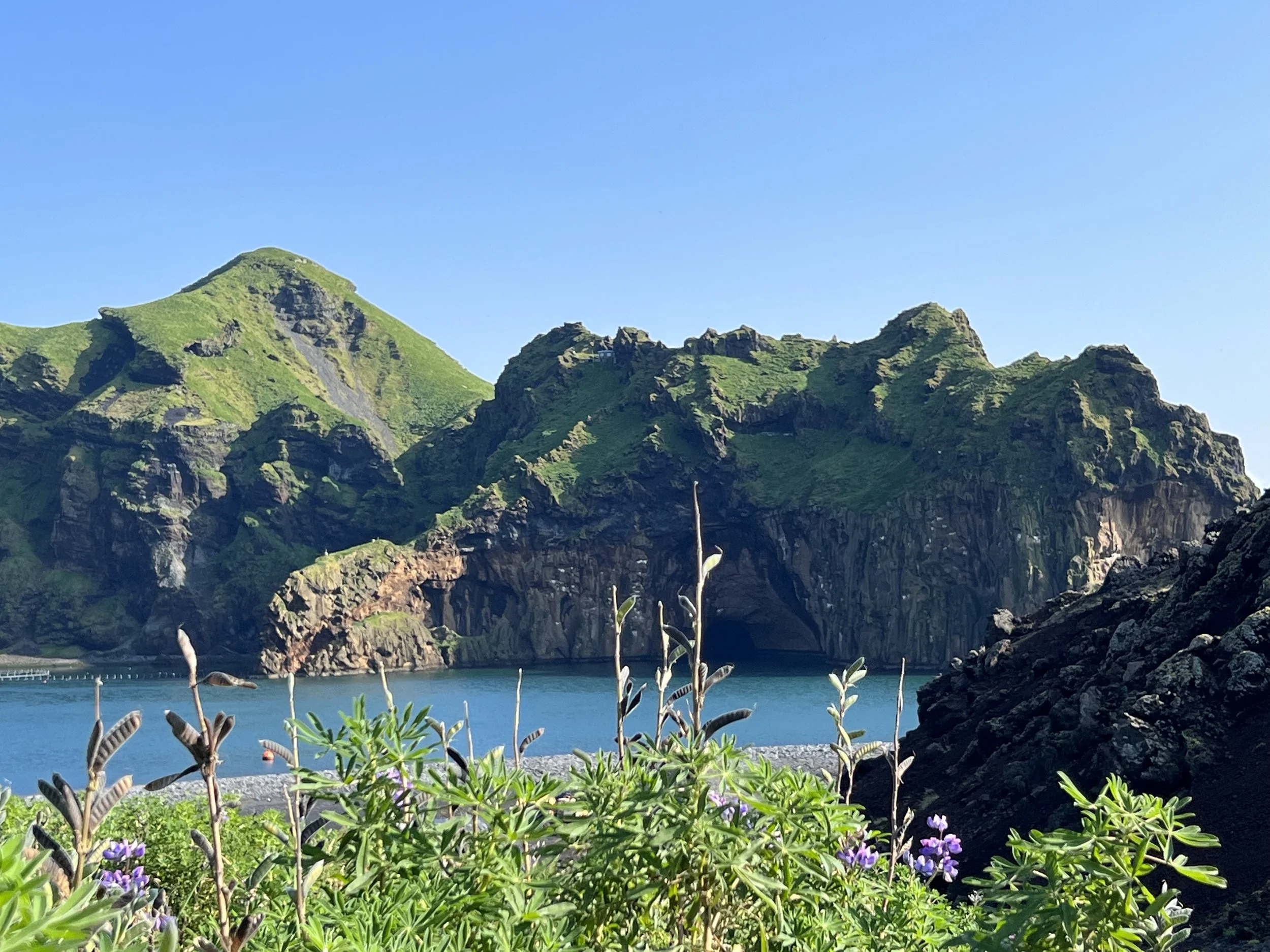
There are several things that are well worth doing to make the most of a trip to Vestmannaeyjar; the first being a boat trip around the islands. There are a number on offer, either on a normal passenger boat or an inflatable rib. The rib tours are quicker, taking just an hour, whereas the boat tours are a little longer, but either way you get the chance to see Vestmanaeyjar from a completely different perspective. I took the boat trip and we were able to go quite close to many of the small islands (some of them not much more than huge lumps of rock) which are uninhabited.
However, every island has one small house on it. These are hunting lodges that are owned by various local associations, and people still go and spend time in these hunting lodges, which I gather are very well equipped and sometimes almost luxurious (I gather there is some competition between the various associations as to who has the best hunting lodge!).
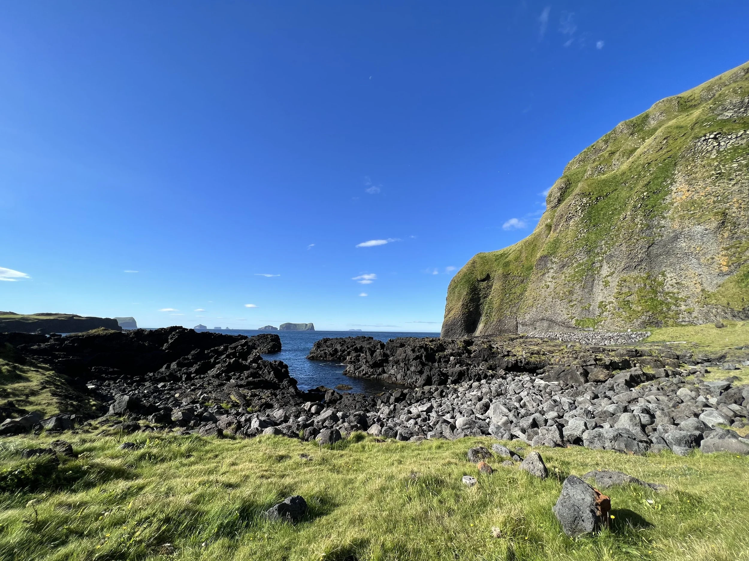
However, many of these islands can only be accessed by boat, and then a steep climb up the rocky cliffs using ropes and chains. They are very remote indeed. We also got to see the famous Elephant Rock from the boat. It can be seen from the lovely golf course on the mainland, but it was nice to see it close up – it really does look like an elephant drinking. We also were able to see many of the birds’ nesting areas and watch them out at sea, including of course the puffin colony at Stórhöfði.
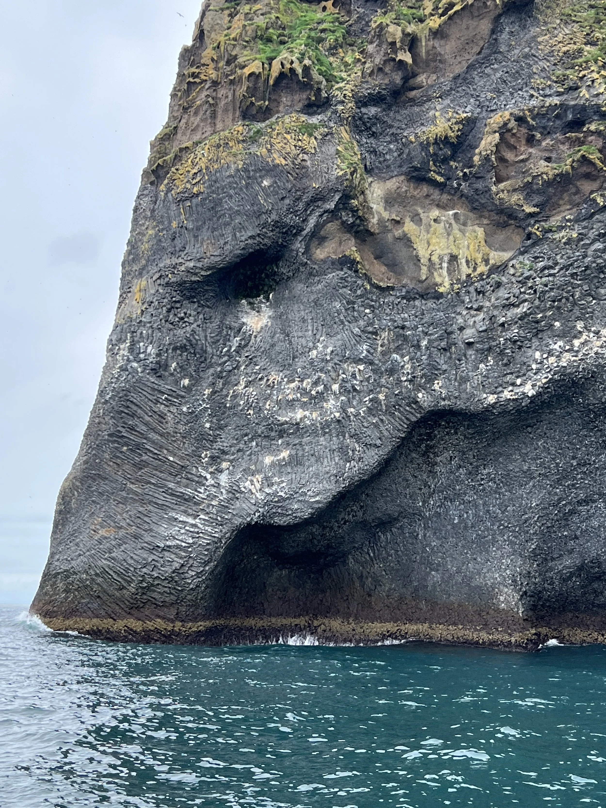
Elephant Rock seen close-up from the boat
The guide on the boat was also very interesting, telling us many fascinating stories about life on Vestmannaeyjar, both recent (the eruption and evacuation) and also some of the fascinating history of the island, telling us about the so-called ‘Turkish Invasion’ when pirates from Algeria invaded. The pirates landed on Heimaey and proceeded to pillage and plunder, burning farms, houses and the church, and killing or kidnapping 242 of the island’s 500 inhabitants. Those who were kidnapped were transported to the slave market in Algeria and most of them were never able to return to Iceland. The inhabitants who escaped the pirates during the attack had hidden in caves and at cliffs along the ocean. Many place names on the island are reminiscent of this terrifying attack, such as Pirates’ Bay and Hundred Man Cave.
A tour around Heimaey by bus
On one of my early trips to the islands I did the the most popular of the bus tours, which is called the Volcano and Puffin Tour. We drove around the island on a minibus and learned about the history of Vestmannaeyjar (not your typical minibus tour where you just sit inside the whole time – we were getting in and out of the bus to explore each stop with the local guide, Ebbi, who I think is the owner of the company and who guides all the tours).
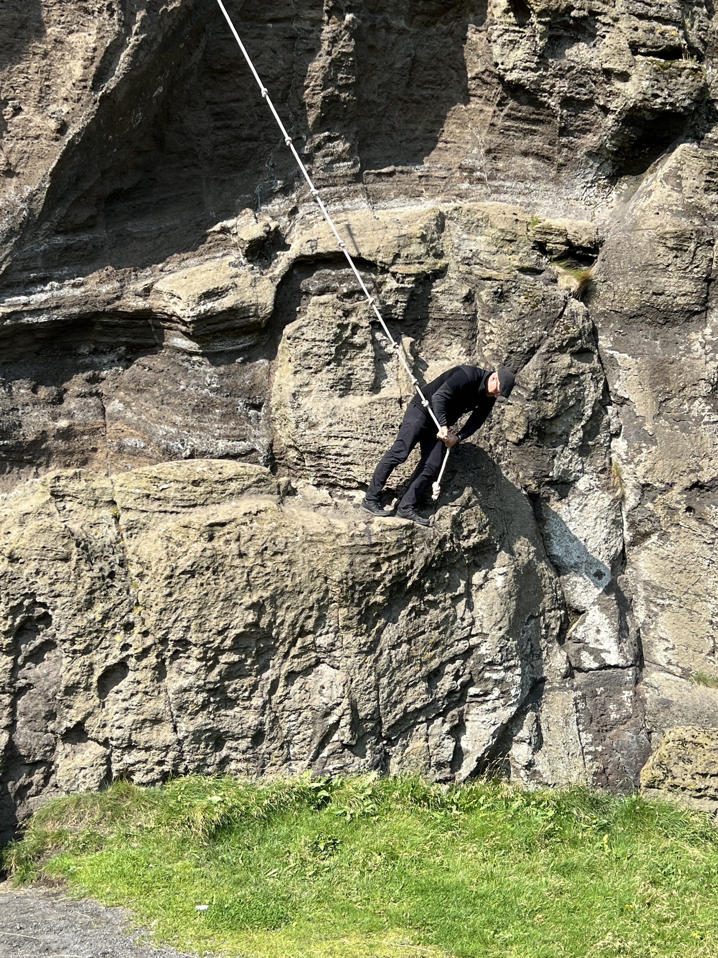
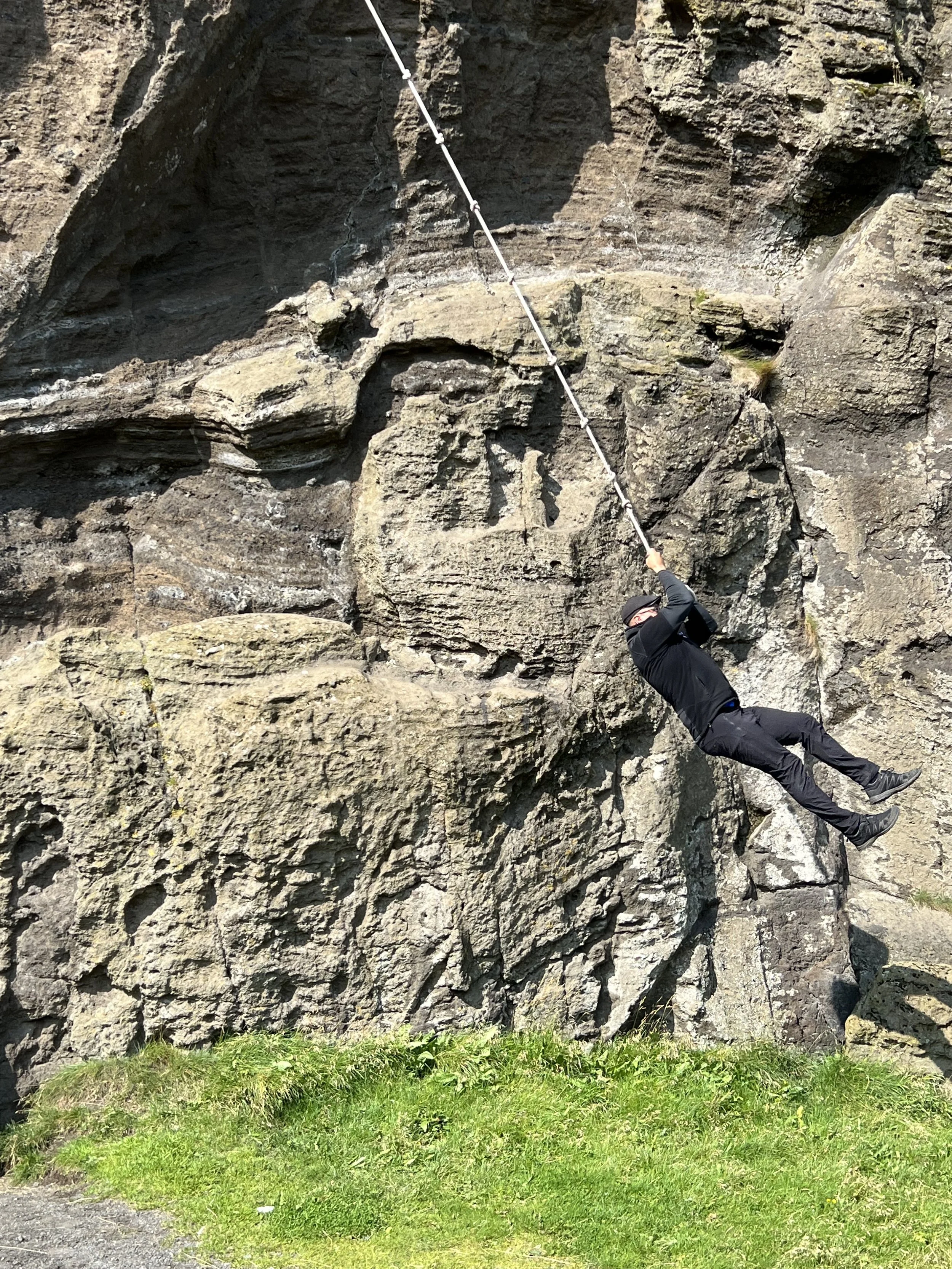

Ebbi shows us how spranan is done!
Stops on the tour included the Sprangan cliffs (where the local children learn the art of sprangan - scaling and swinging on ropes on the cliffs – this is how back in the day they scaled cliffs to collect birds eggs!), Herjólfsdalur – where the first viking family settled on the islands, Eldfell the volcano that erupted in 1973, not all the way up the volcano – but to a point halfway where Ebbi told us stories of the eruption), Stórhöfði (the windiest place in Europe and home to the puffins), Elephant rock seen from the golf course, and the large natural amphitheatre which is the location for Vestmannaeyjar’s famous annual three-day music festival.
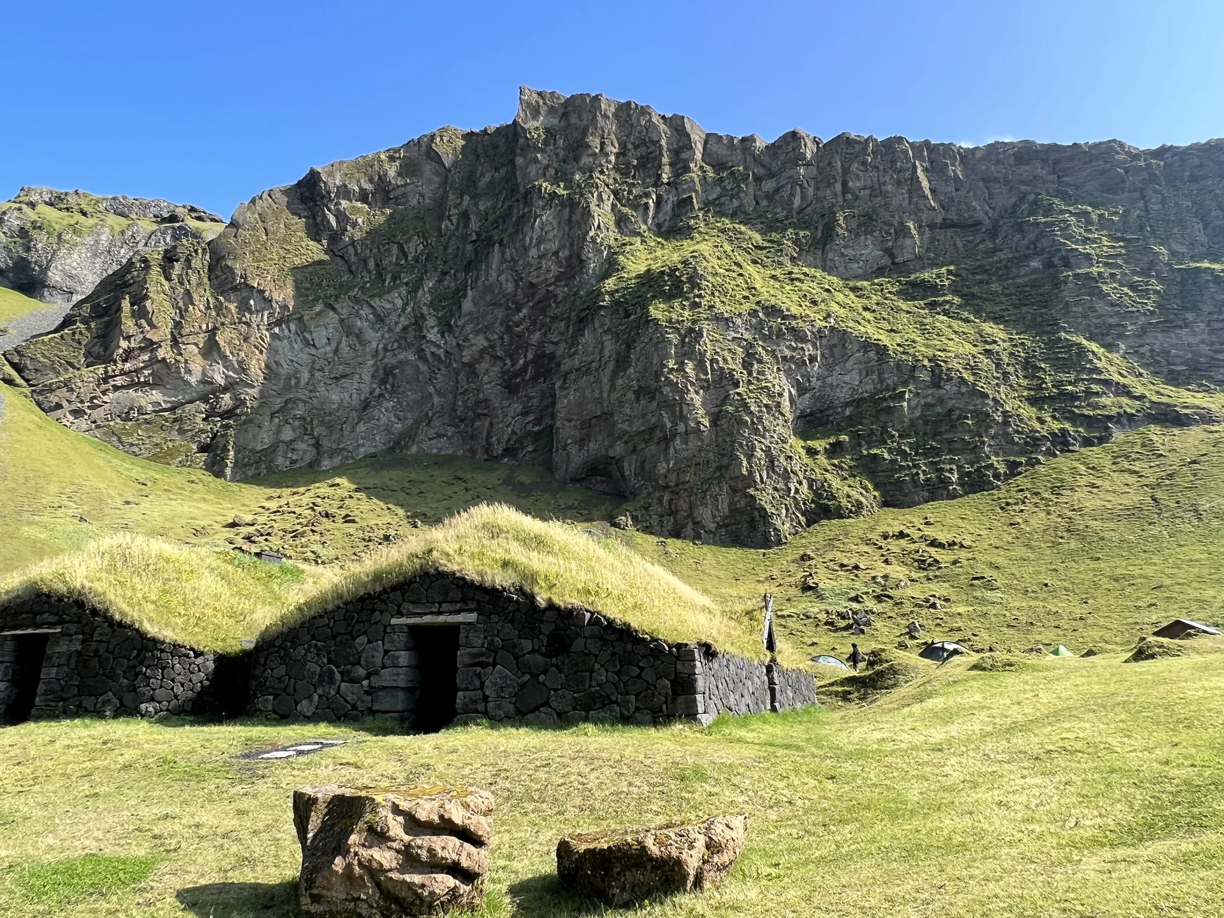
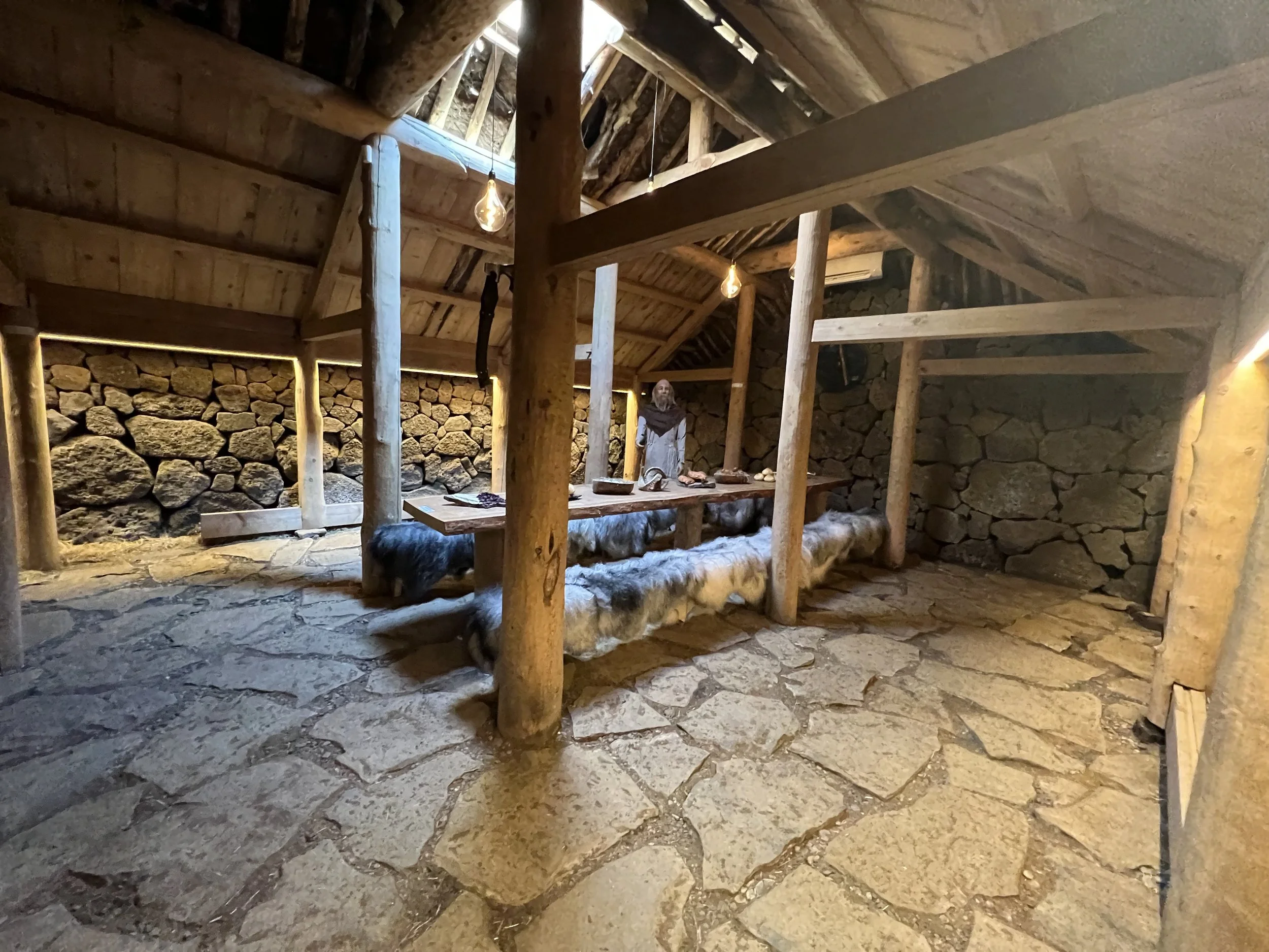
The reconstructed viking homestead
Ebbi also showed us around the reconstruction of a viking homestead in Herjólfsdalur which he is using to teach the local schoolchildren about the history of their island, complete with models and furnishings. This is kept locked so the only way I´m aware of that you can visit and have a look round is to do the tour.
Ebbi is a great character and really good guide. The tour lasted about an hour and a half to two hours and was a wonderful way to get to know a lot about the island in a short time.
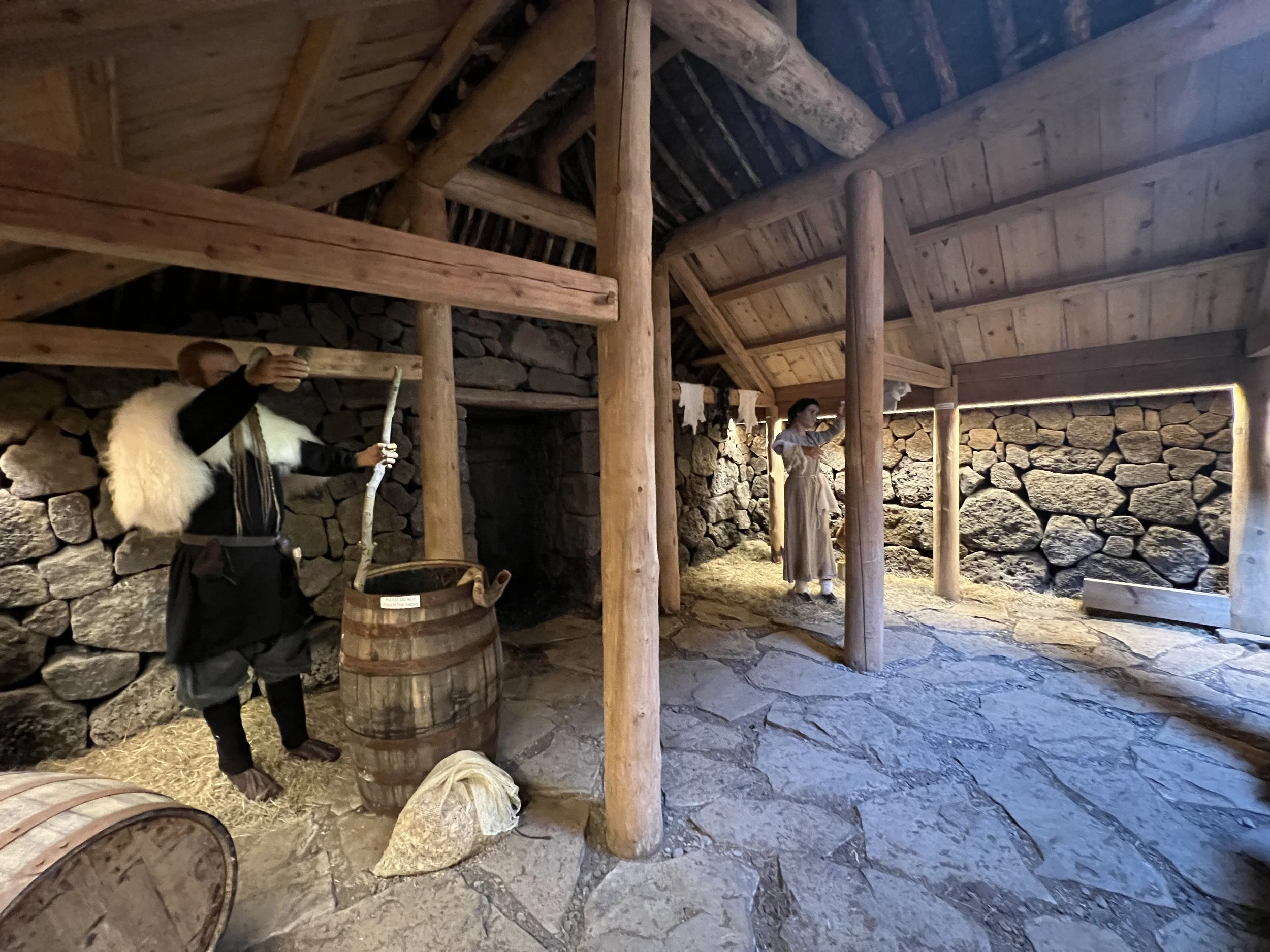
Sea Life Trust – the Beluga Whale sanctuary and puffin rescue centre.
This is an amazing place; the new home for two beluga whales, Little White and Little Grey, who were rescued from a Chinese zoo where they lived in captivity doing tricks for visitors. When you first go in, you can walk through the centre, where you will see a short video about the rescue of the belugas, as well as lots of aquarium tanks with different fish and sea creatures. There is also a hospital area for puffins who are ill or injured, and some seem to be pretty much permanent residents. However, for me the most exciting thing was being able to see Little White and Little Grey up close. They will never be able to be released fully into the wild as they are too damaged from their captivity but they will eventually end up in a large bay in the harbour where they will lead a more natural life. Incidentally, this is not the first time that this bay has been a home for a whale. Keiko, the whale that starred in ‘Free Willy’ was looked after here for a while until his release back into the wild. For the moment Little White and Little Grey are in the holding/observation pool and there is a big picture window in the sea life centre where you can watch them swimming.
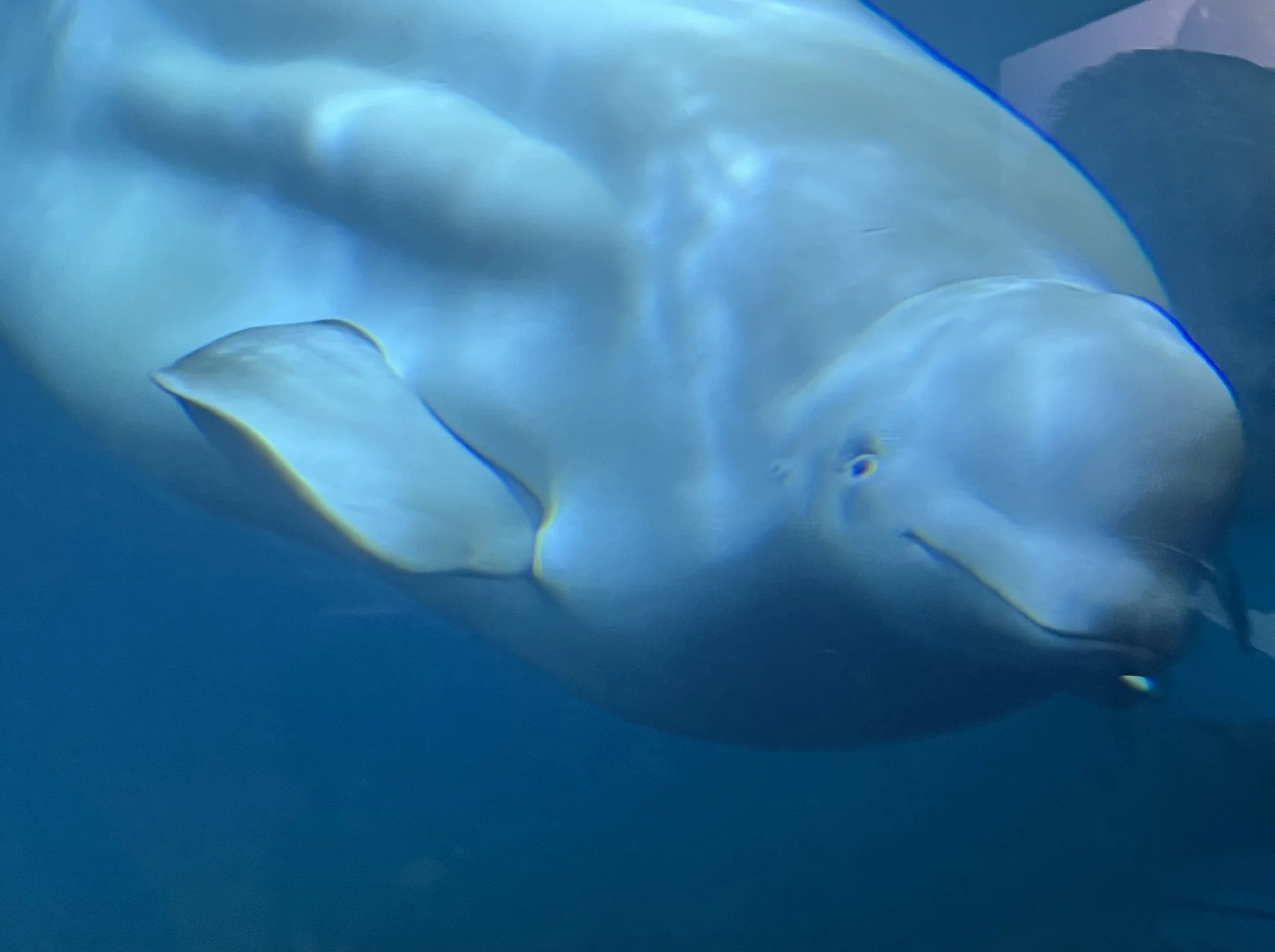
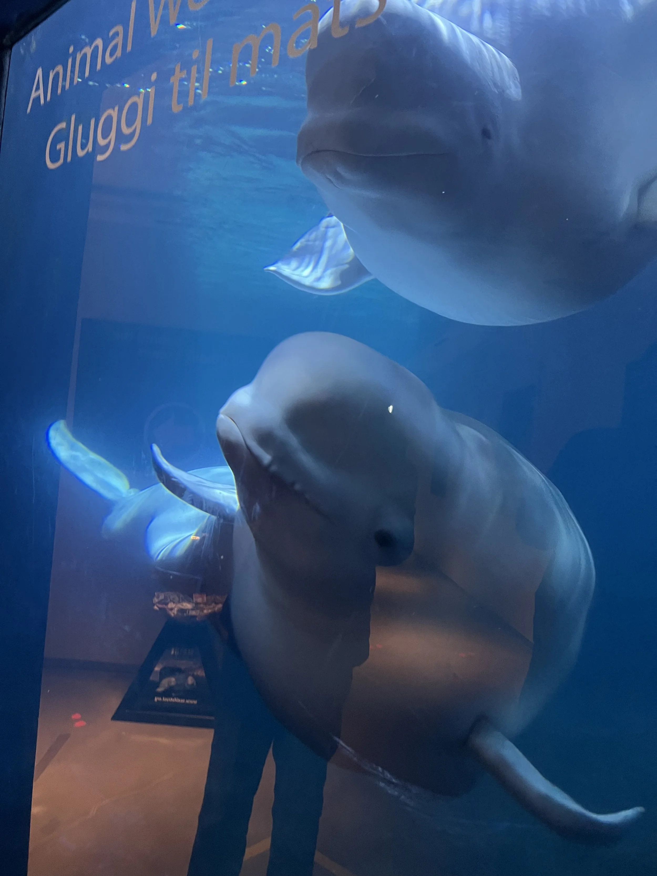
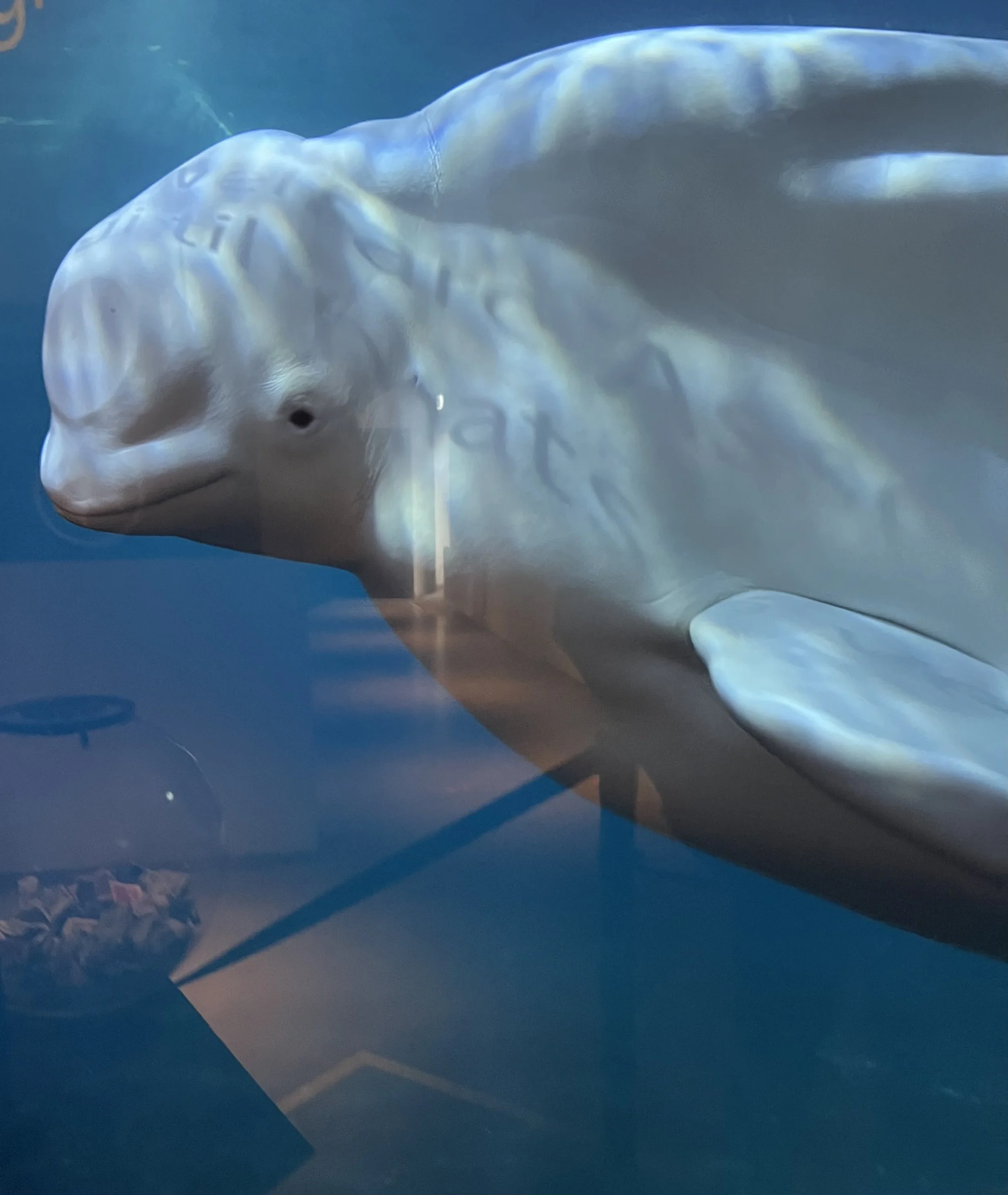
Little White and Little Grey
I couldn’t tear myself away and, even though I’ve been a few times now, I can easily spend a long long time here, just watching these lovely whales as they swim. By staying there quietly and letting them get used to you, they will begin to interact with you after a while. It’s clear that they can see us and they will swim round and watch the people watching them. They can be quite interactive and playful. It’s an absolute joy to see such weird yet gentle creatures up close.
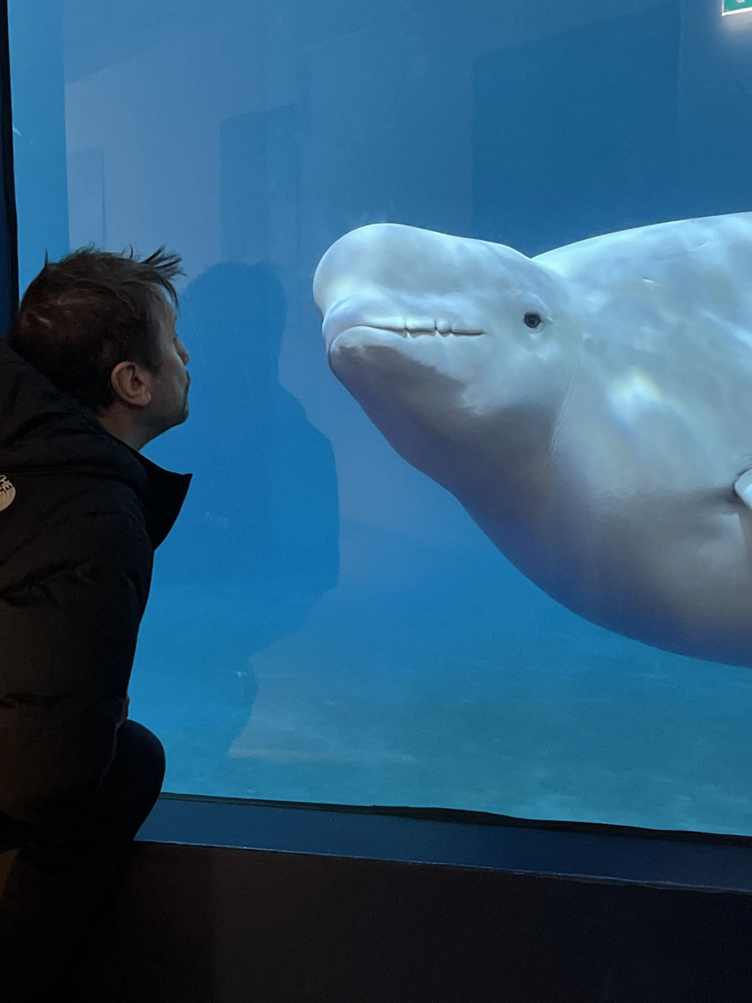
Matthew meets Little Grey up close
The Eldheimar Museum
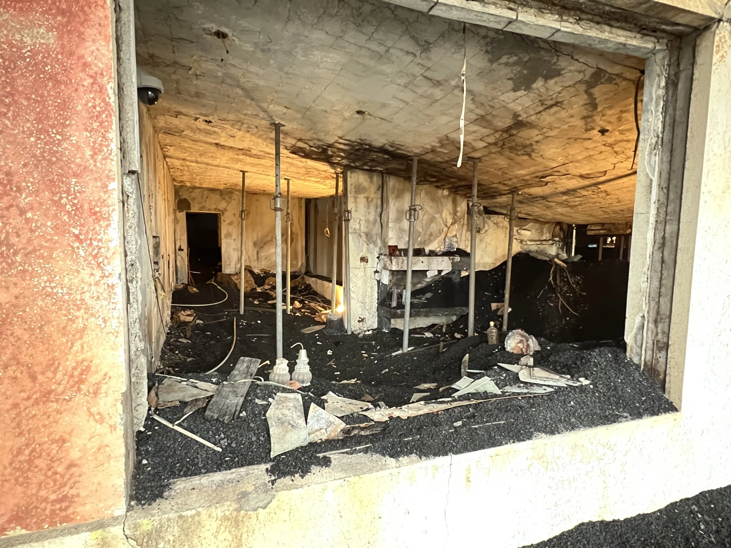
After the 1973 eruption of Eldfell, the archaeologists were uncovering what remained of the buildings, and found that one of them was almost entire – just buried under a layer of lava and ash. These buried homes were frozen in time, just as they were when the volcano erupted. They decided to create a museum, Eldheimar, and to build the entire museum, around the remains of this one particular home. They nicknamed Heimaey the “Pompeii of the North”. It was fascinating to hear the history of Heimaey and the story of the eruption. You can get an audio guide that tracks you through the sections of the museum. The stories on the audio are so interesting and add so much to the experience, as you get a real sense of what it must have been like for the villagers at the time and what they went through.The guide is informative and some of the hands-on displays are really excellent. At Eldheimar there is also a section where you can also learn about the Surtsey eruption that created the world’s youngest island. One of the best museums I’ve been to here – and that is saying something, because the Icelanders do love their museums and there are a lot!
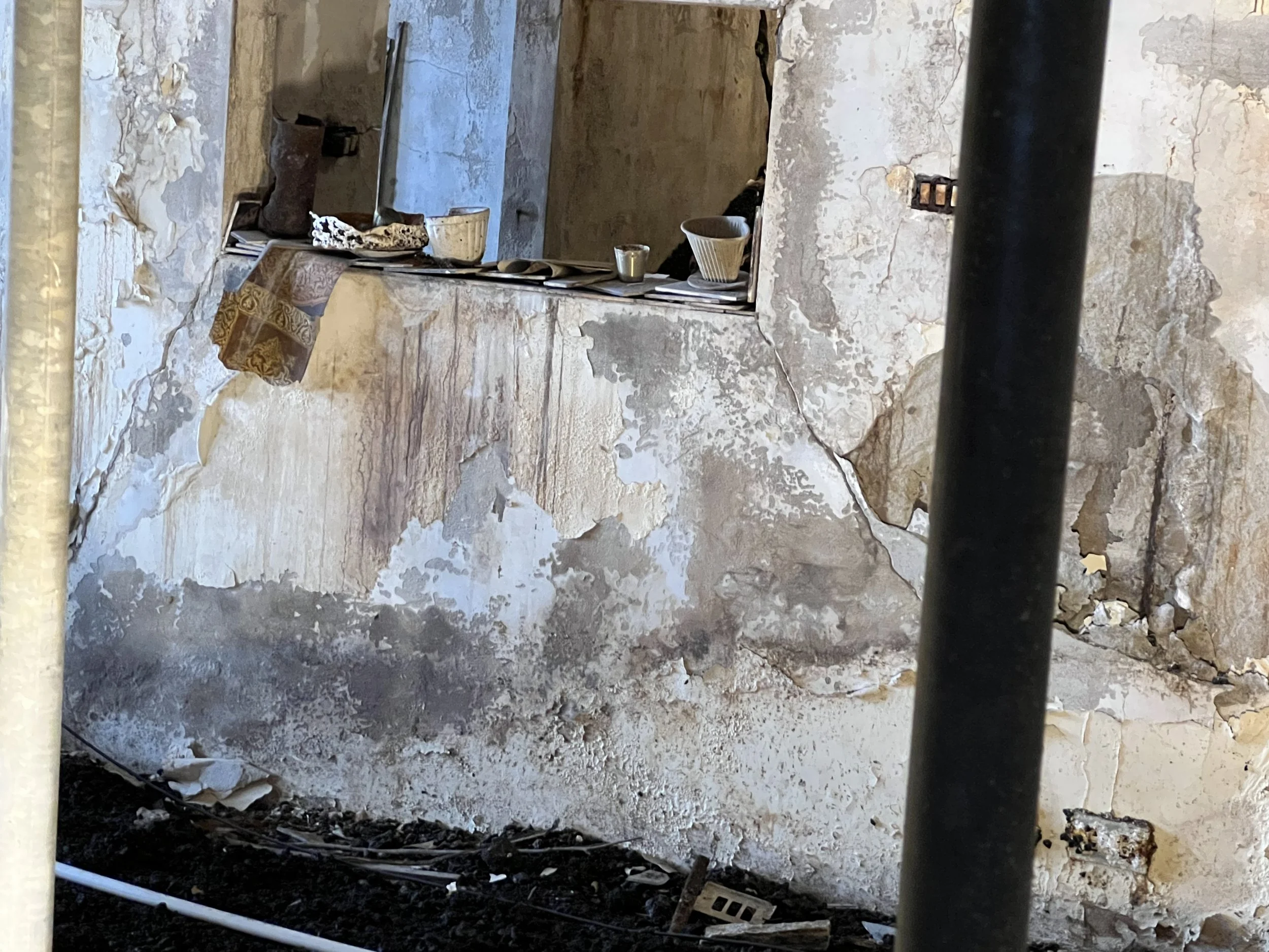
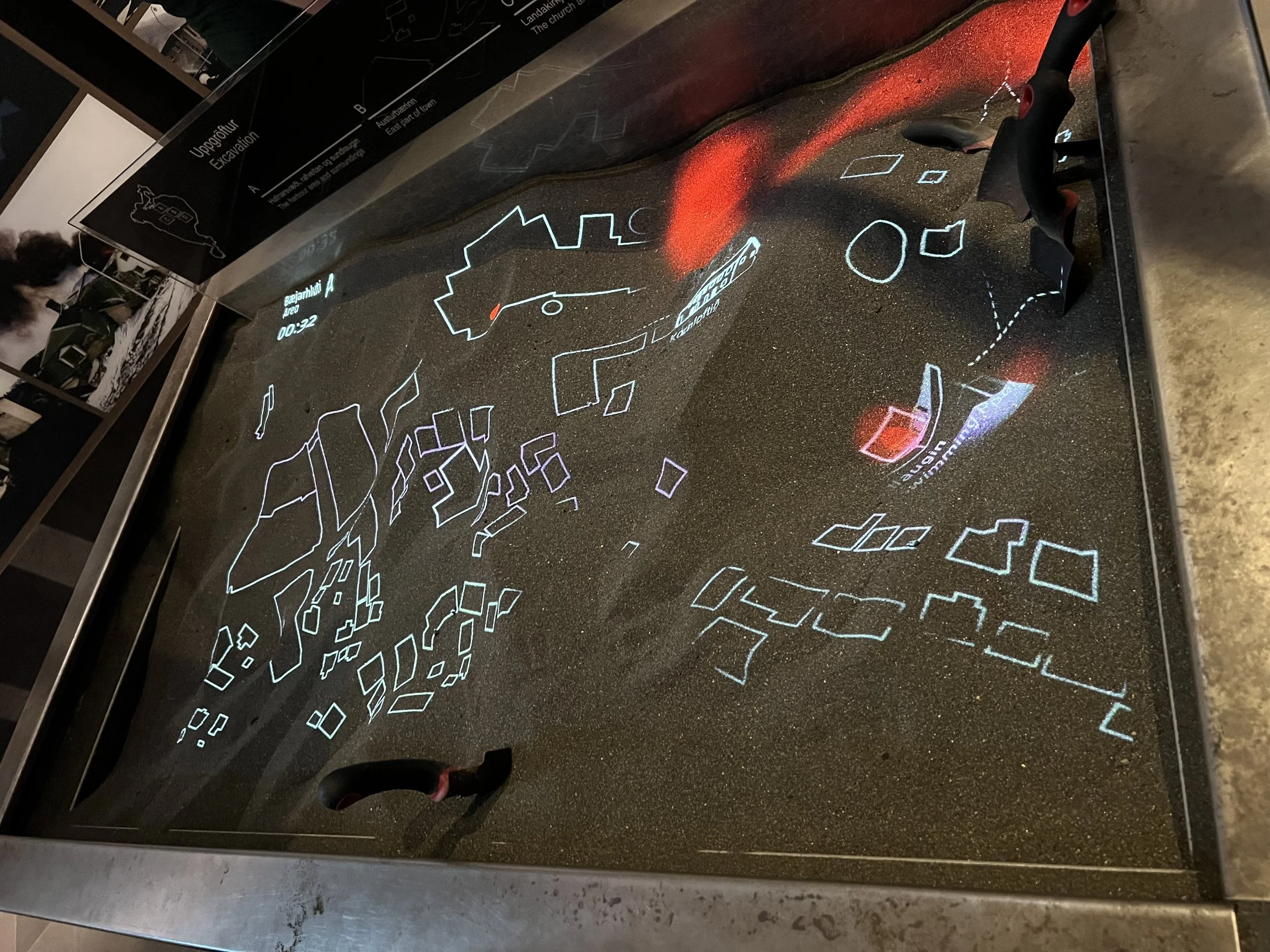
Some of the museum displays
Stafkirkjan
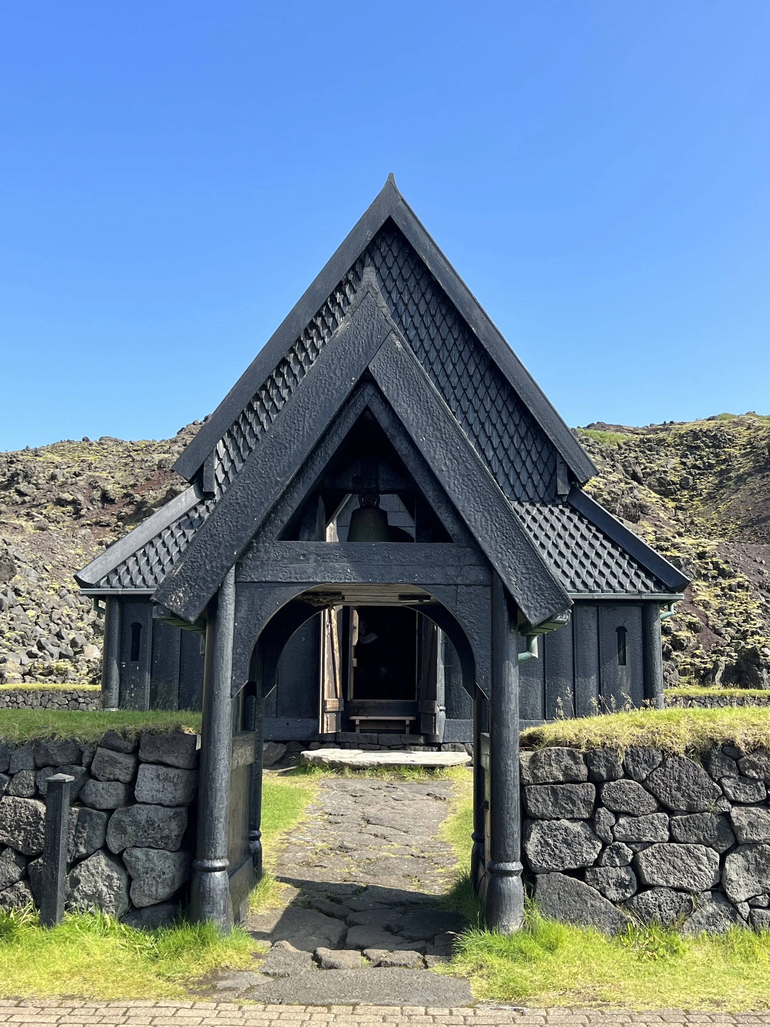
Stafkirkjan from the front
Down near the harbour is a grassy area called Skansinn (Danish for ‘fort’) where a fortification was built in 1586 at the request of the Danish king in order to defend this Danish monopoly trade post from the English. After the Turkish invasion in 1627, the fortifications at Skansin were rebuilt as the people felt it was necessary to defend against further invasions. A cannon from 1586 still stands there today. There is also a display giving the history of the water and electricity supply to Vestmannaeyjar near a huge water tank that was partly buried by the lava of the 1973 eruption.
But the reason I wanted to go down to this area was to see the Stave Church (Stafkirkjan). This is a gorgeous black church which was gifted to Iceland by Norway. It was built in the year 2000 to commemorate the 1,000th anniversary of Iceland’s conversion to Christianity, and is a replica of the first church in Vestmannaeyjar. The Norwegians built the church with great care and attention to detail: the timber was selected specially and every single board was worked by hand.
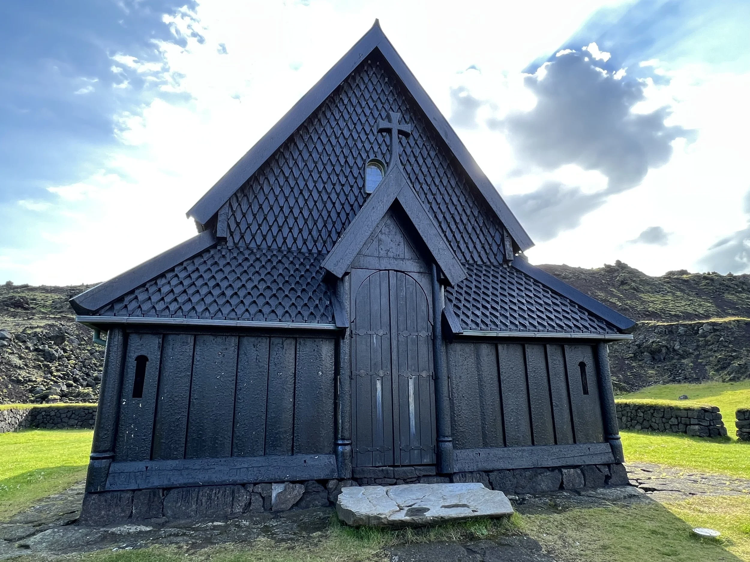
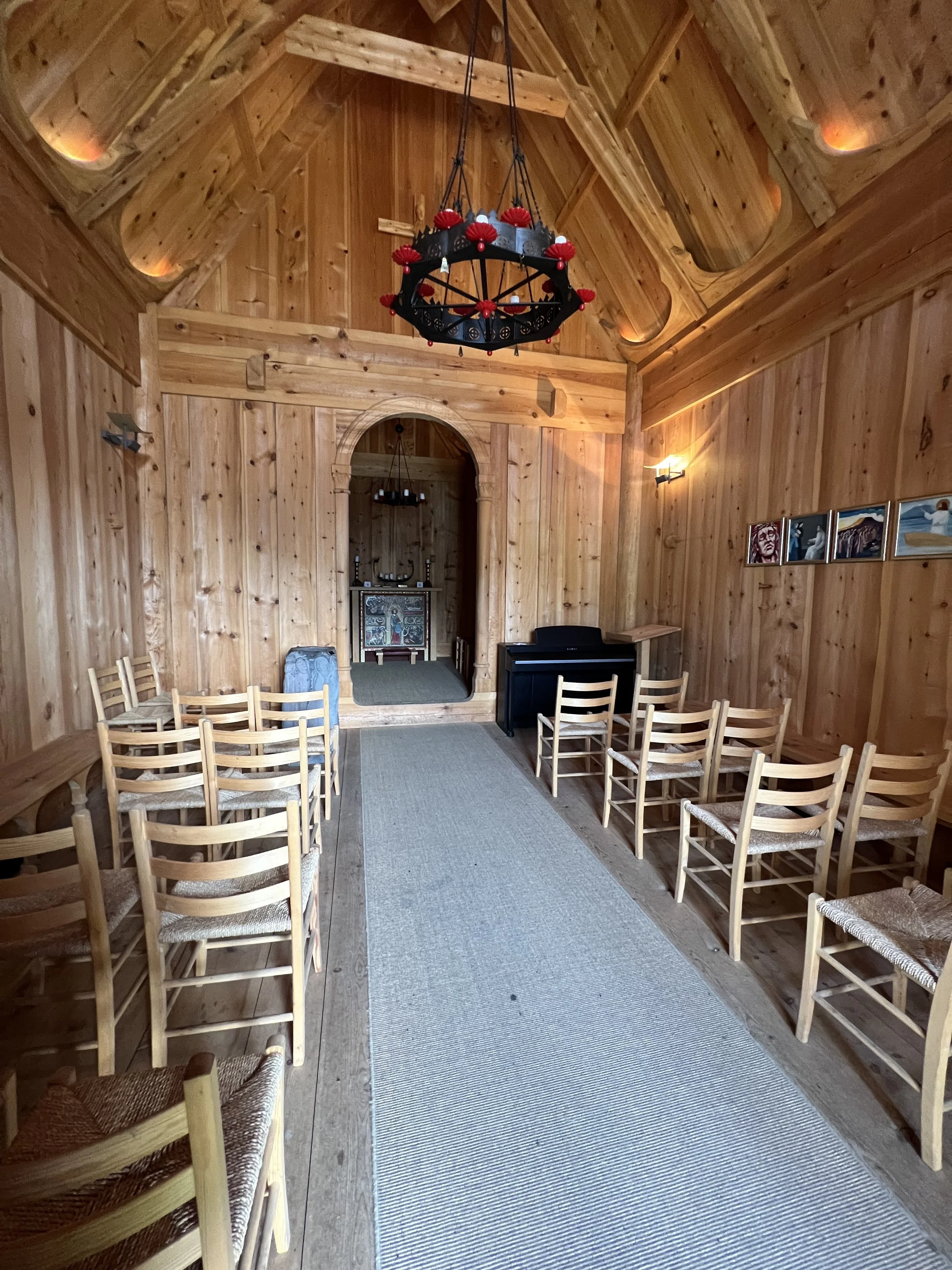
The exterior and interior of the stave church
Mass is held at the Stave Church a few times a year, and it’s often used for events such as weddings. There’s also a tradition of holding masses to commemorate the beginning and end of the Heimaey eruption.
The church is not locked and you can go inside and have a look around the tiny wooden structure, where there is a replica of the Norwegian medieval altarpiece of Saint Olav.
Just up the slope from the church is a replica of the first maternity hospital in Iceland which was located in the centre of Heimaey. It is now a medical museum and also well worth a visit.
Hraunskógur and the lava field

Hraunskógur
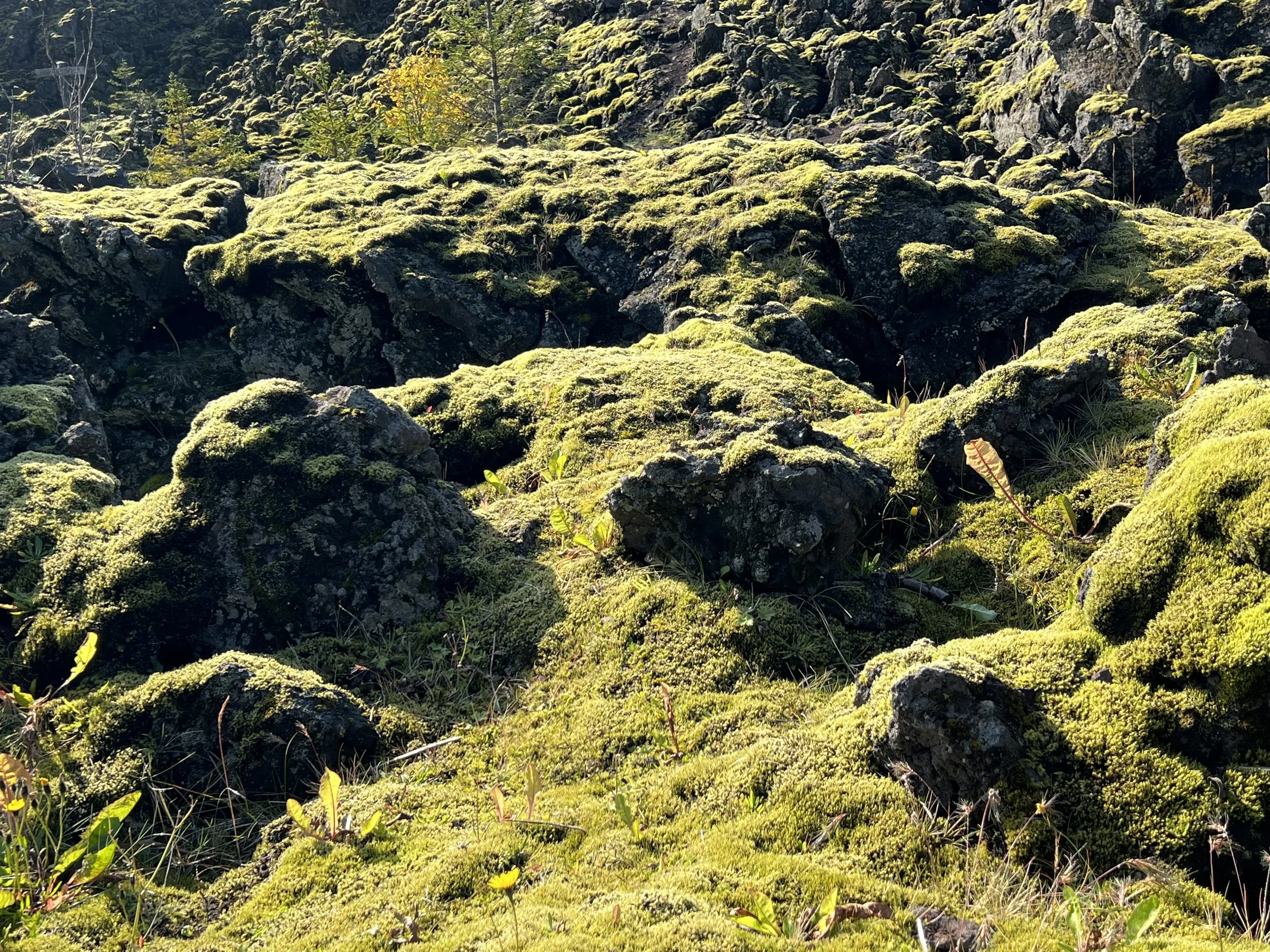
One of my favourite areas of Heimaey island is the lava field itself. To walk up there from the harbour is to enter a different reality. Although only a few metres away from the town, it feels a world away. Within moments of setting off, it feels as if you are alone in a natural oasis. It’s strange that this area, which saw such devastation relatively recently, feels so peaceful. This area near the harbour and Skanskinn is called Hraunskógur (The Lava Woods) and is a 28 hectare soil conservation woodland. Planting began in 1999 and the following year the Forestry Association of Vestmannaeyjar was created and now oversees the project.
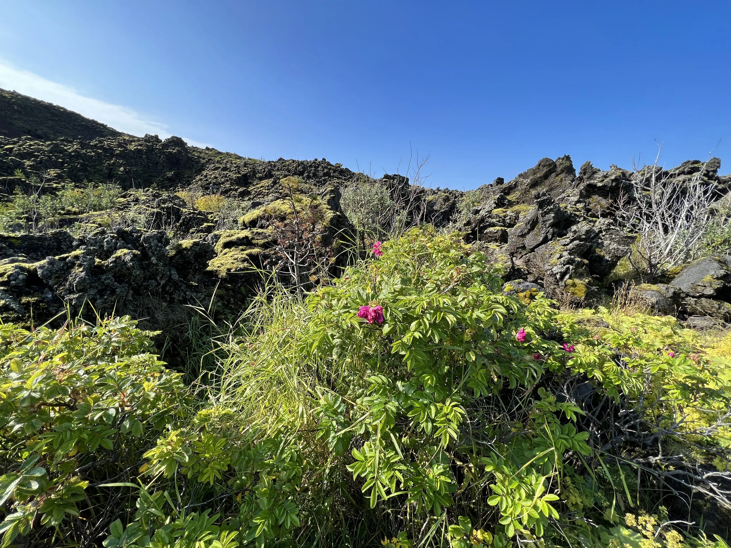
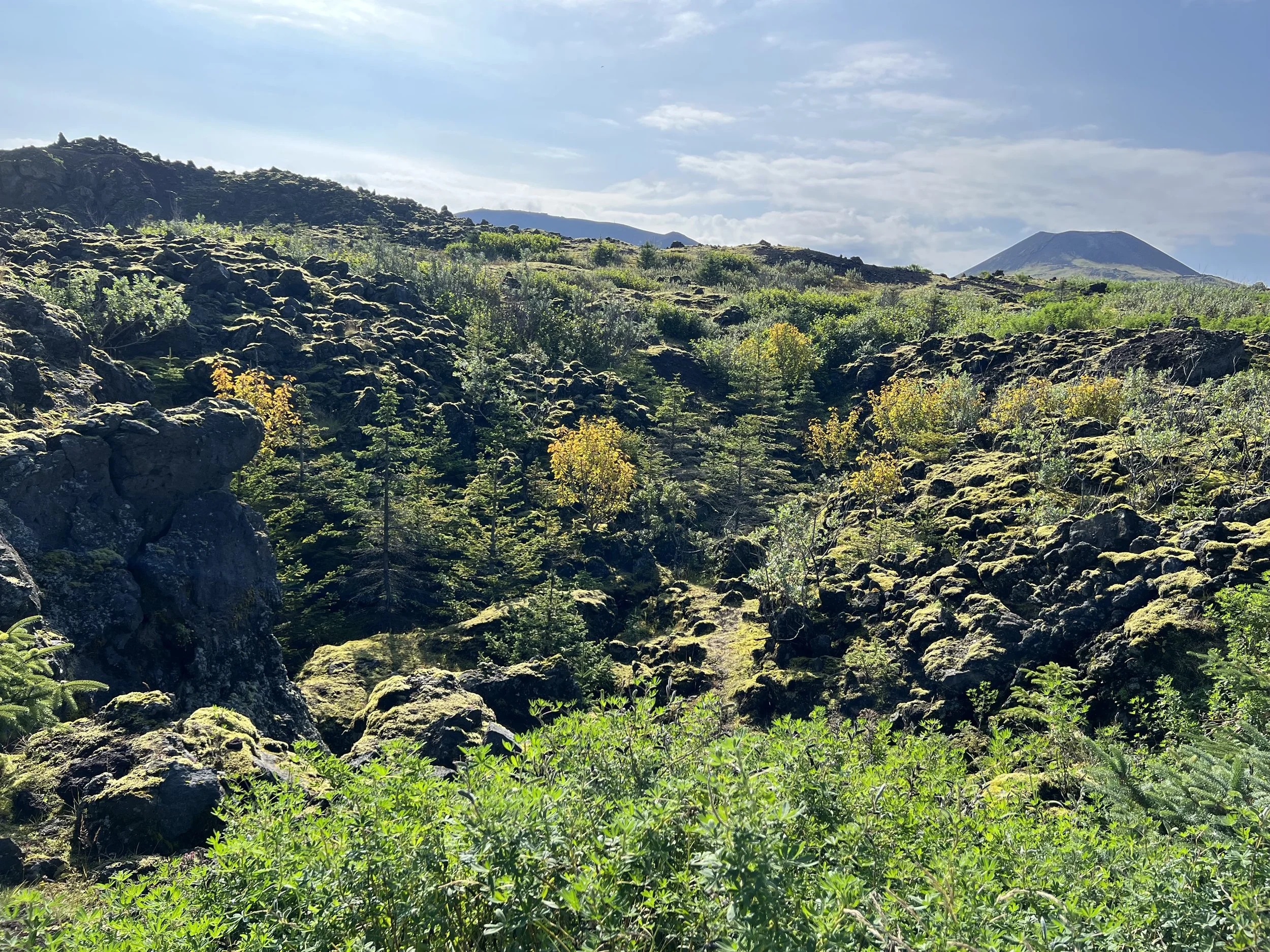
Just some of the beautiful views on the walk
Every year a mixture of volunteers and council staff plant about 4000 young trees. Paths have been constructed through the lava using local materials, and there are maps of walking routes. In the summer it is a riot of colour and birdsong. I found myself wandering along happily, forgetting that this was lava and that only a few decades ago, in my lifetime, it was the cause of so much pain and panic - and then I started coming across the signposts. Every few metres or so I could see a wooden signpost and couldn’t work out what they were. Then I twigged that the signs were all street names and realised that where the streets have been buried beneath the lava, streetsigns have been erected showing where each street was…. There are also many small plaques which have been placed by private individuals, above the point where their homes were, with the name of their house and sometimes a list of names of those who had lived there, or a line drawing of their house…. It was dreadfully moving to see the signs and the plaques and to realise that a few metres below my feet were the buried remains of streets and buildings - people’s homes that were suddenly engulfed and lost, along with all their belongings and mementos, leaving only memories. It was very strange to be in a place that is at once so beautiful and yet so poignant.
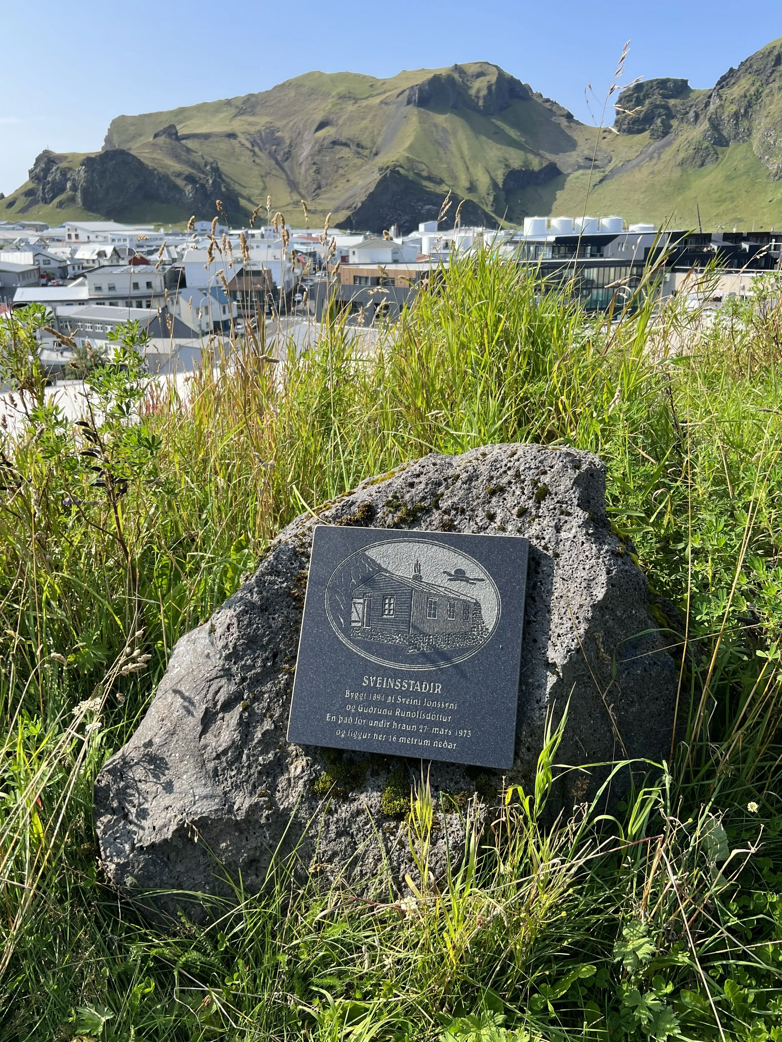
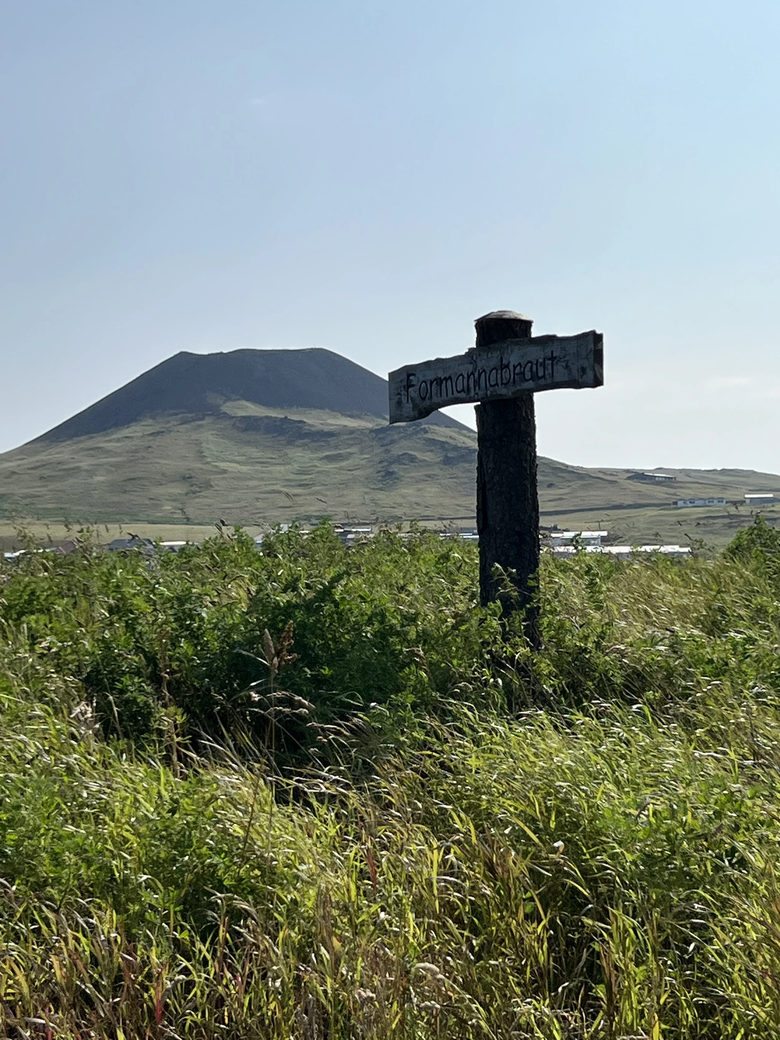

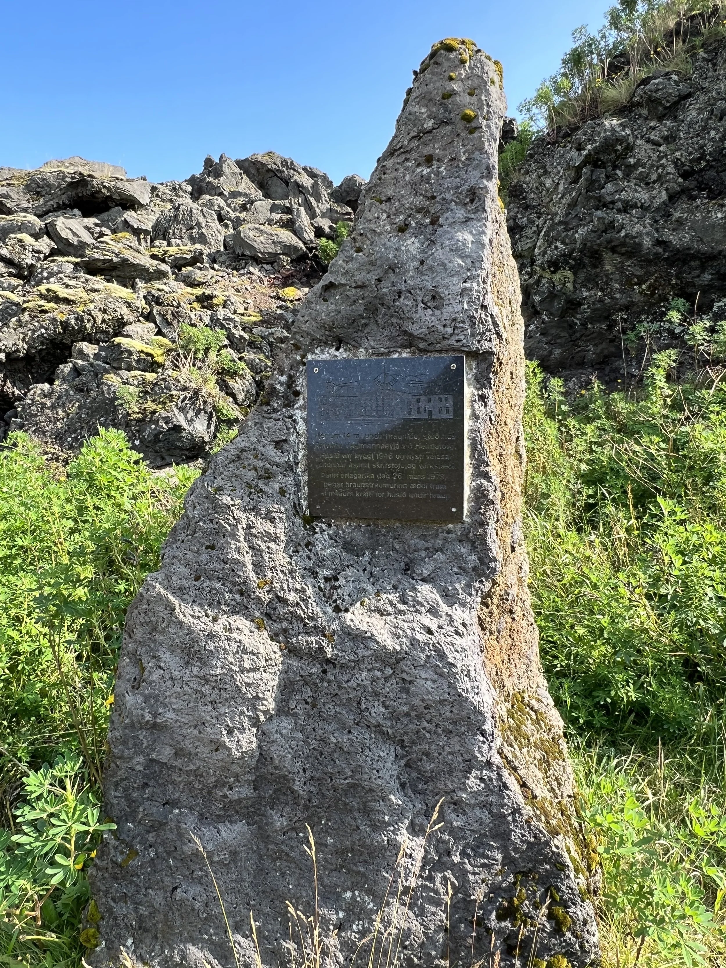
Remembering the streets and homes that were lost
Climbing the volcanoes
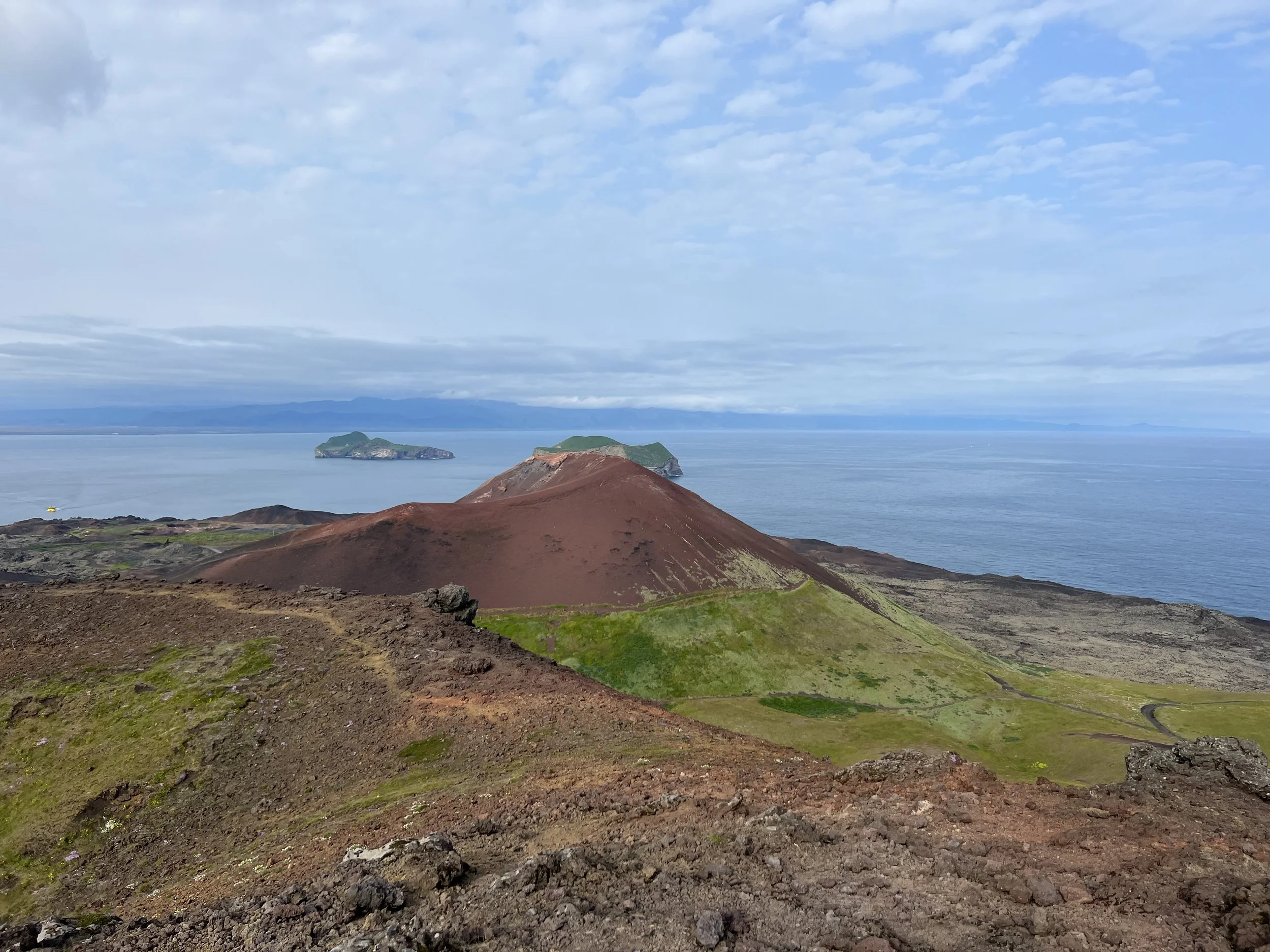
It is possible (and highly recommended if you have the time) to hike up both Helgafell and Eldfell. the two hikes are not that difficult, although Eldfell, being the more recent and therefore more popular, is the one most visitors choose. The impressiveness of Eldfell is undeniable. But on busy days it can also be a bit of an ant heap, with lots of people going up & down the tracks and circling around its crater, all at the same time. Especially in high season and when there’s a cruise ship in the harbour.
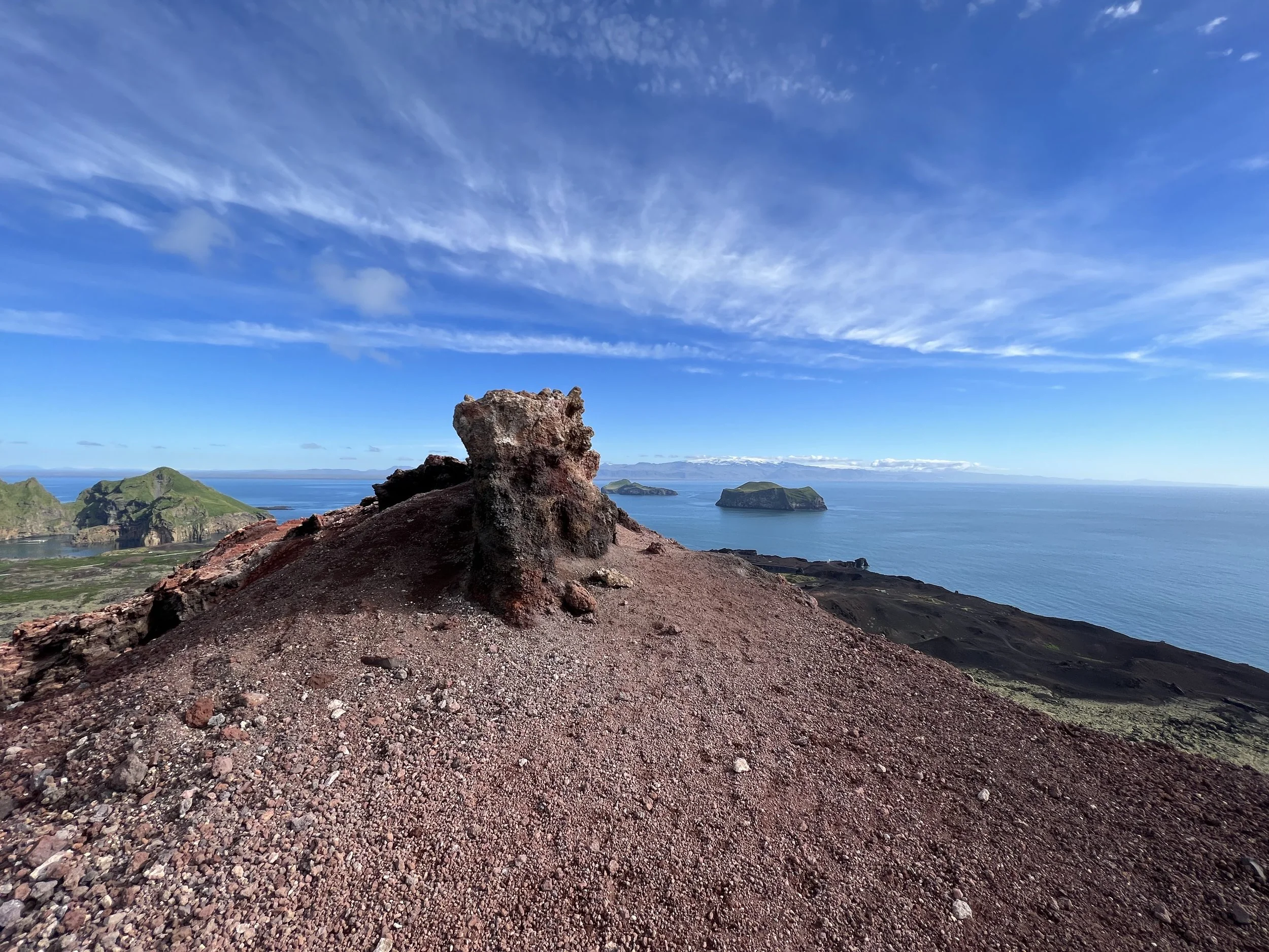
In the meantime, you may very well have Helgafell with all its beautiful views virtually for yourself. Helgafell has a heart-shaped crater and a viewdial on the top, with the names of the mountains that can be seen in all directions.
The view from the viewdial at the top of Helgafell
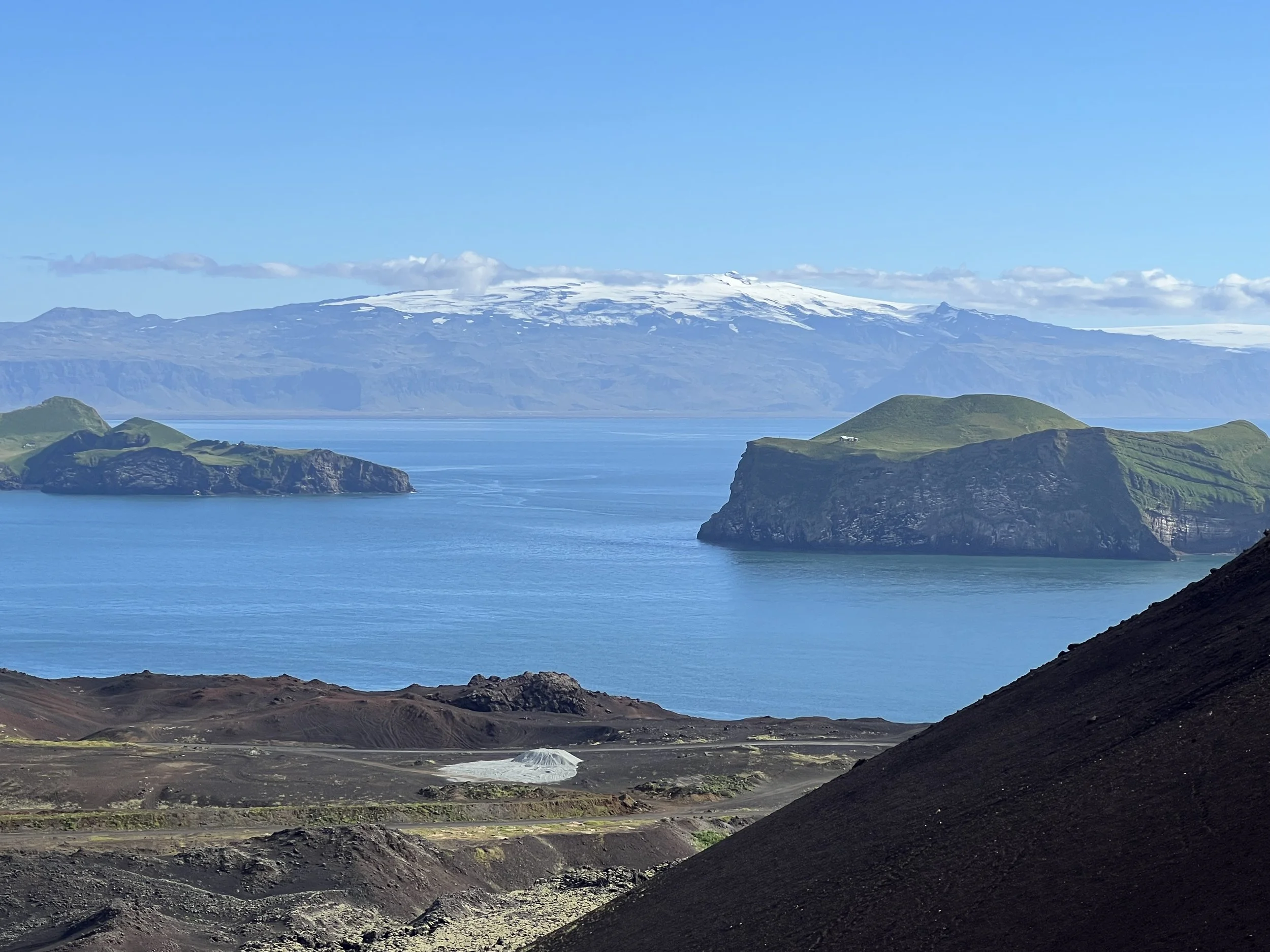
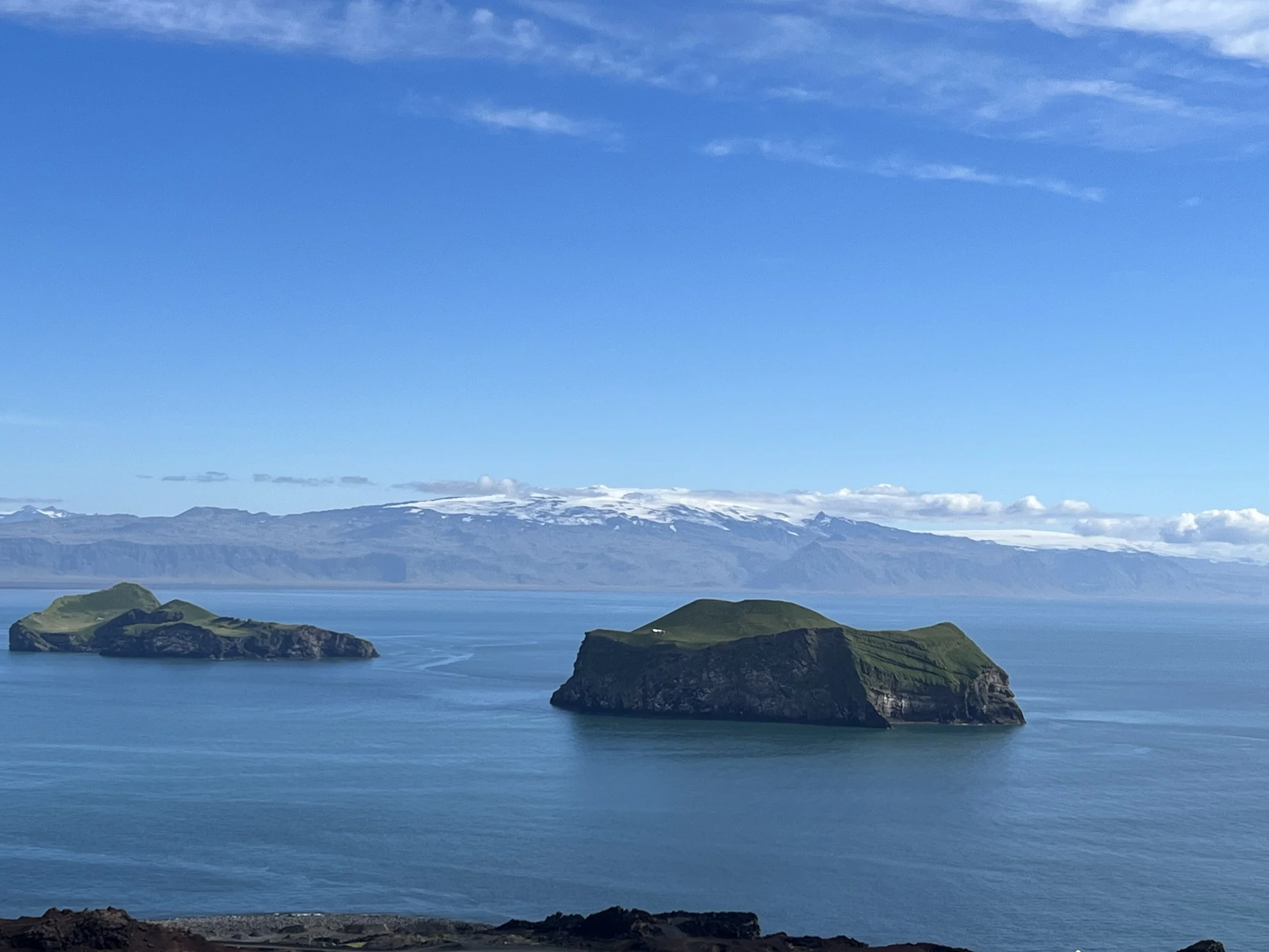
The track up to Helgafell can be somewhat challenging in parts, due to its steepness and loose gravelly bits along the way. But it doesn’t take that long to hike to the top. There is a grassy path from the road towards the north side of Helgafell until you see a steep and rough path going up. Before you take on the rocky upper slope, you can turn left into a grassy field for some beautiful views of Eldfell and the nearby islands of Elliðaey and Bjarnarey. Looking over towards the mainland you will also see the ominous Eyjafjallajökull volcano (the one that caused the ash claud and stopped all european air traffic in 2010).
It gets a bit grittier on the upper part of Helgafell. In the meantime, arctic flowers are taking hold and blooming in spite of the harsh weather and poor growing conditions on the gravel slopes. Once you get to the top, broad and sweeping views unfold all around you. Behind Helgafell there’s a breathtaking view towards Eldfell, the lava flow that came from it, and the remains of the fissure that erupted out of nowhere.
Views from Helgafell
Having walked up the North side of Helgafell, we chose to descend down towards the south, ending up on the road that runs between Helgafell and Eldfell. The whole walk takes around an hour to an hour and a half and is about 2 kilometres or so from the information sign on the airport road.
The Eldfell climb is a little easier, without as much steep gravelly path but is a similar distance and probably takes about the same time as Helgafell to climb. I have been up there when it is very busy but I´ve also been lucky enough to have Eldfell to myself, having set off early in the morning. As mentioned, the hike to the top of Eldfell is probably the one every visitor to Heimaey wants to do. Eldfell itself is very colourful, the track is easily accessible, and the views are absolutely stunning in all directions. From the top you can look down on the impressive lava flow that only a few decades ago was a red hot molten river that destroyed a third of the town and that also single-handedly enlarged the island by several square kilometers. It’s incredible to think that this mountain didn’t even exist just over 50 years ago…


Looking northwards towards Eyafjallajökull from the summit of Eldfell
There are two paths to reach the top. If you are driving, you can park at the Volcanism Museum located at the foot of Eldfell very close to Helgafell.
From here, take the main road but on foot this time, striking out towards the 2 very obvious volcanic cones. A crossroads will give you the choice to turn left, skirting the foot of the Eldfell on your right, or go around the other way to walk straight between the two volcanoes. It doesn´t really matter which path you take as the two paths converge after 20–30 minutes of climbing. The path that goes straight between the 2 volcanoes gives you a nice view of both flanks rising on either side, and it's the easiest to climb.
Views from the top of Eldfell
After about twenty minutes you get to a first small plateau with a great view of Heimaey from a magnificent perspective, but the real prize is at the top of Eldfell (221 m above sea level) for a panoramic view of the ocean, the island, and the south coast of the mainland in the distance. If the weather conditions are good you will get a fantastic view of Eyjafjallajökull from the top.
Another beautiful view of the Eyafjallajökull glacier
The trail cuts across the volcanic cone with increasingly contrasting red and black of ash and pumice all the way to the summit. The last 300 meters are a little steep and slippery in places, but the view at the top is worth it.
One of the very cool things about the Eldfell hike that not many people know about is that near the northernmost end of the summit there is a little hollow, almost like a baby cave, and if you get down on your hands and knees and put your hand into the hollow you can still feel the heat of the volcano! 52 years later!! According to the locals, many of them as children used to be able to wrap frankfurter sausages in foil, bury them in the soil and they would actually cook! I don´t think it´s that hot now but even so, to be able to still feel the residual heat, half a century after an eruption is quite something.
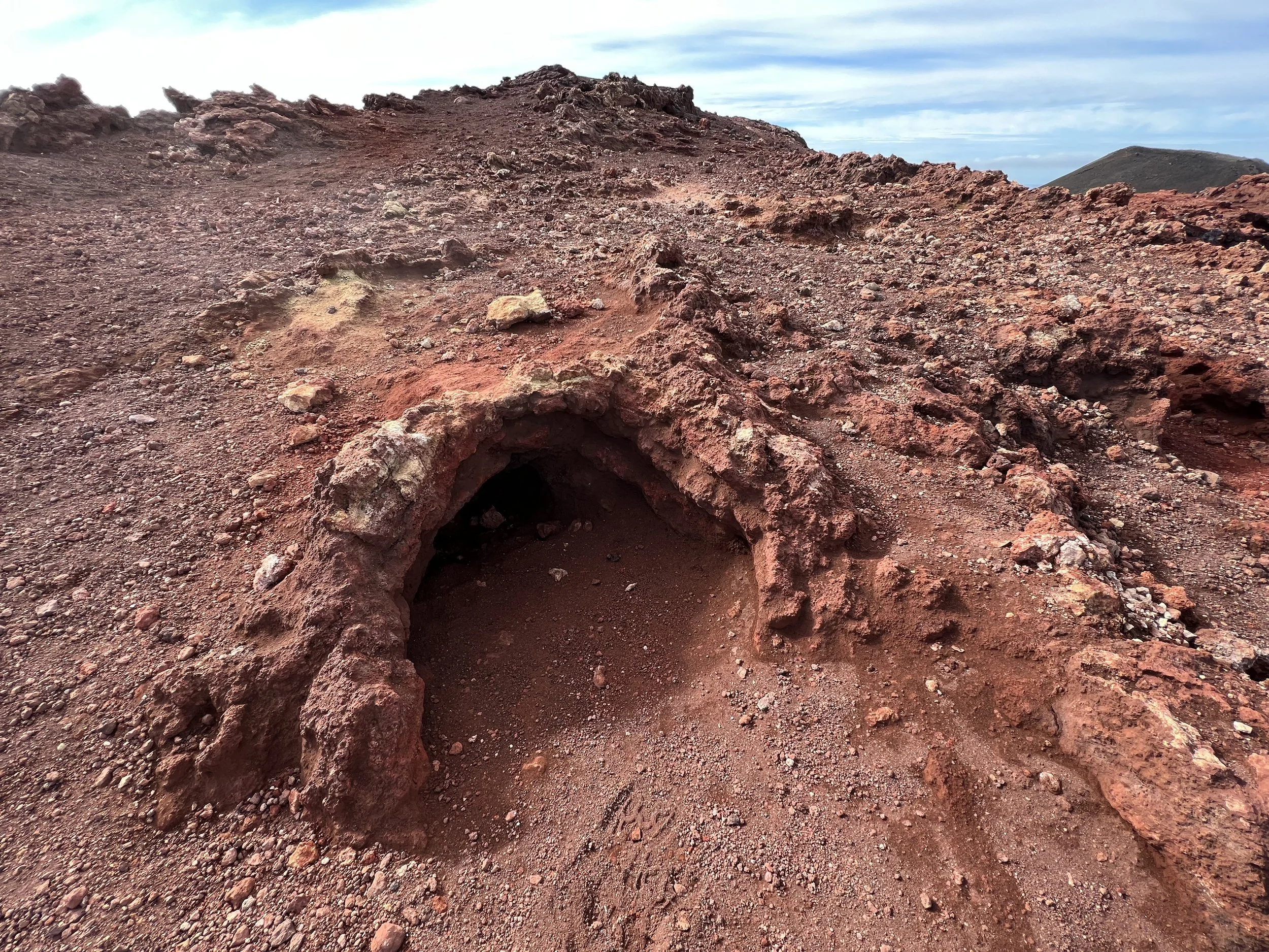
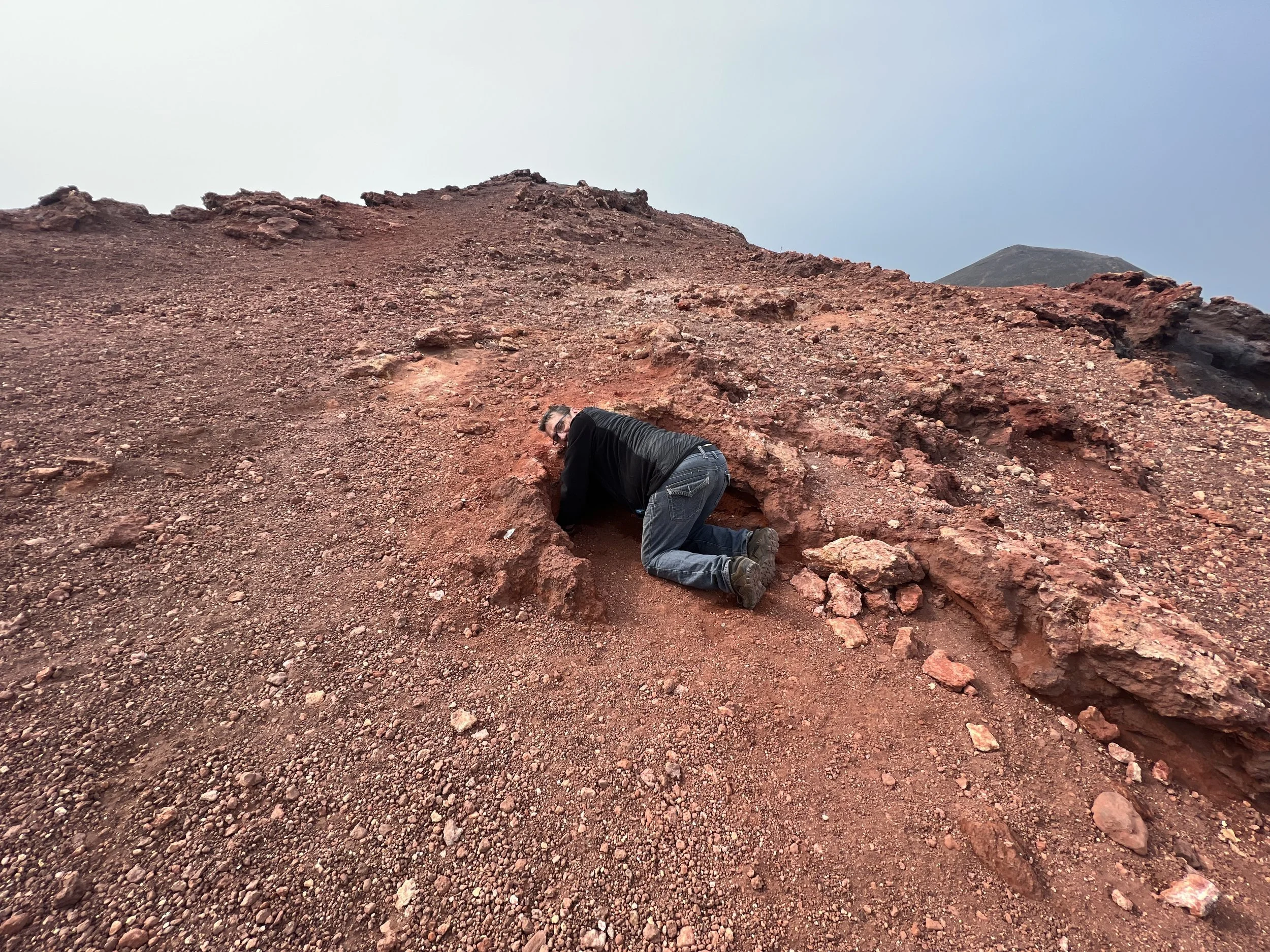
The little hollow where you can still feel the heat from the heart of the volcano!
Playing golf on Vestmannaeyjar
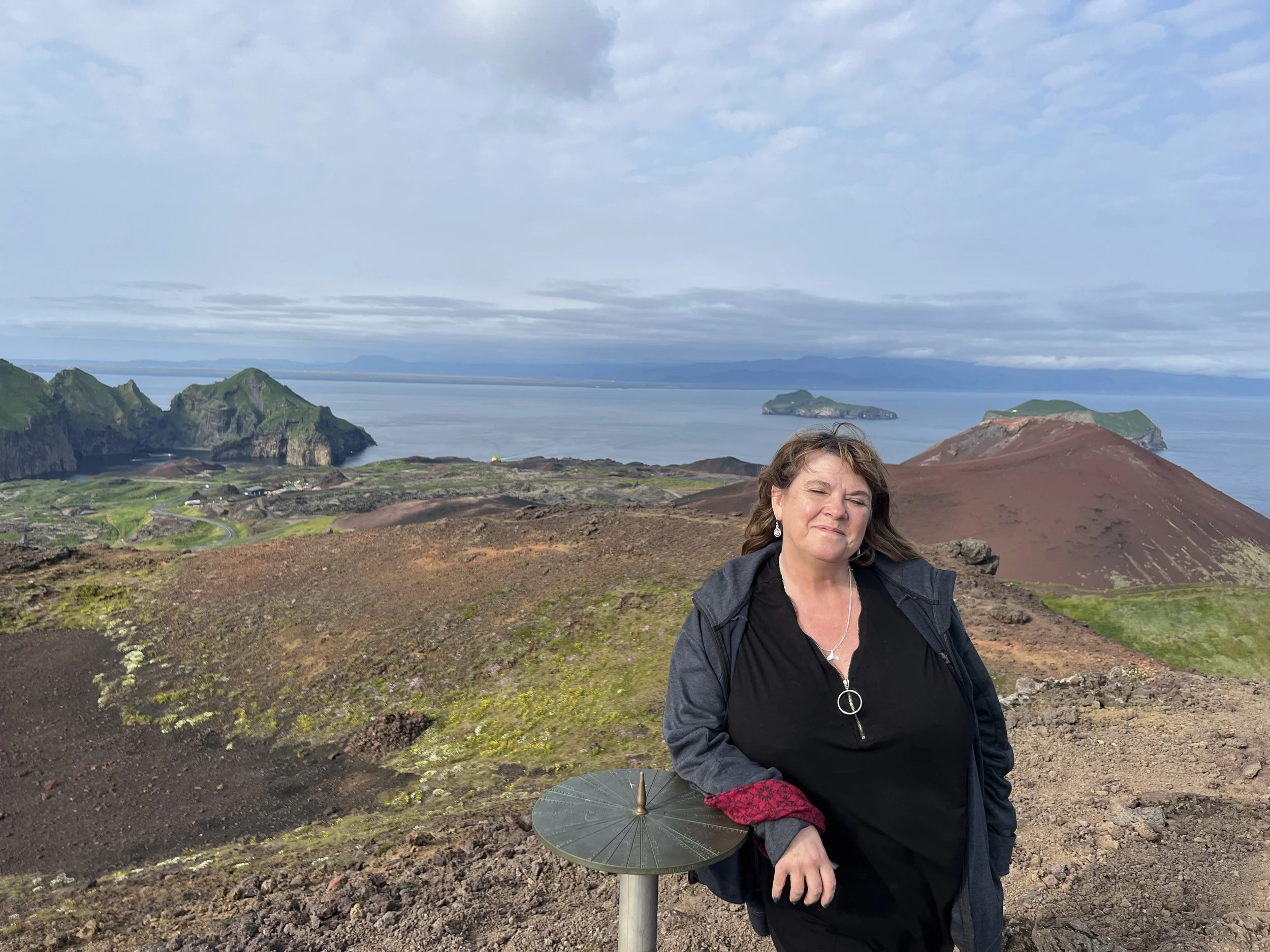
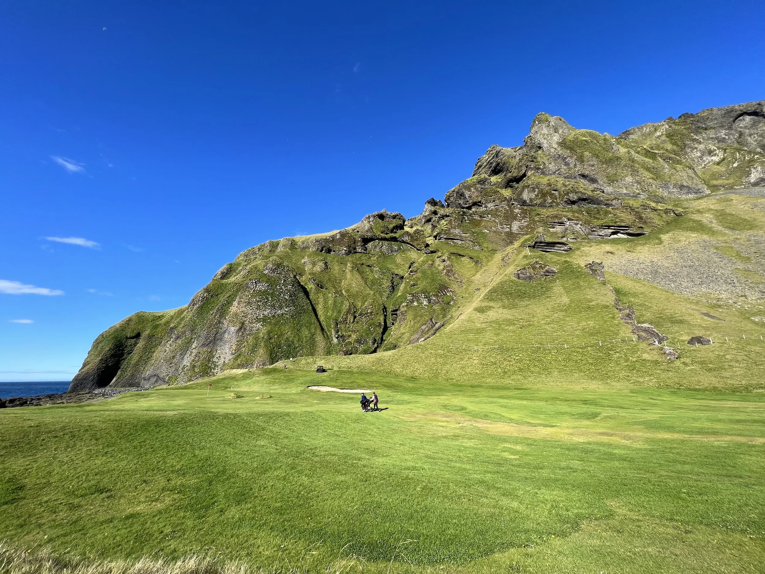
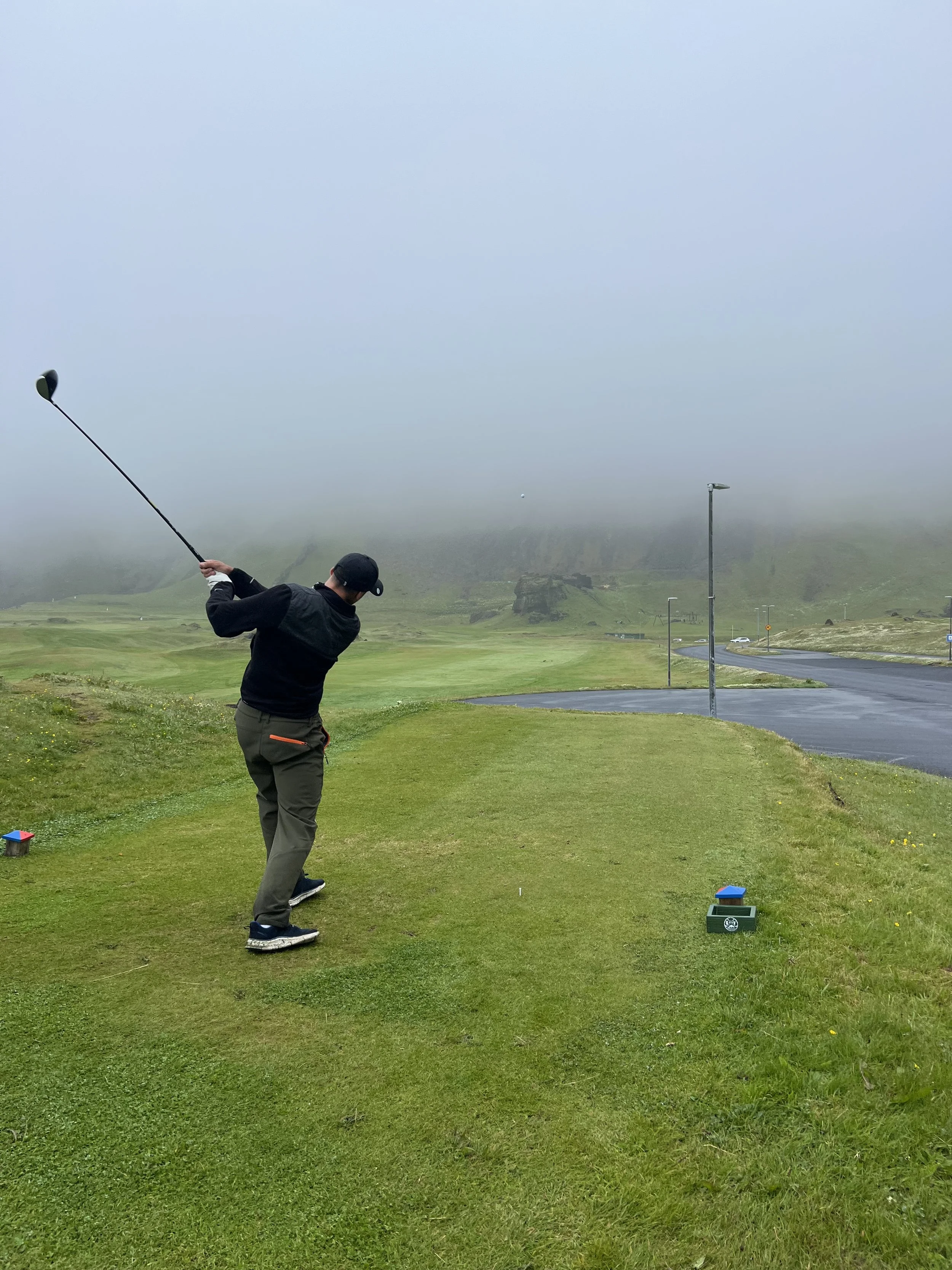
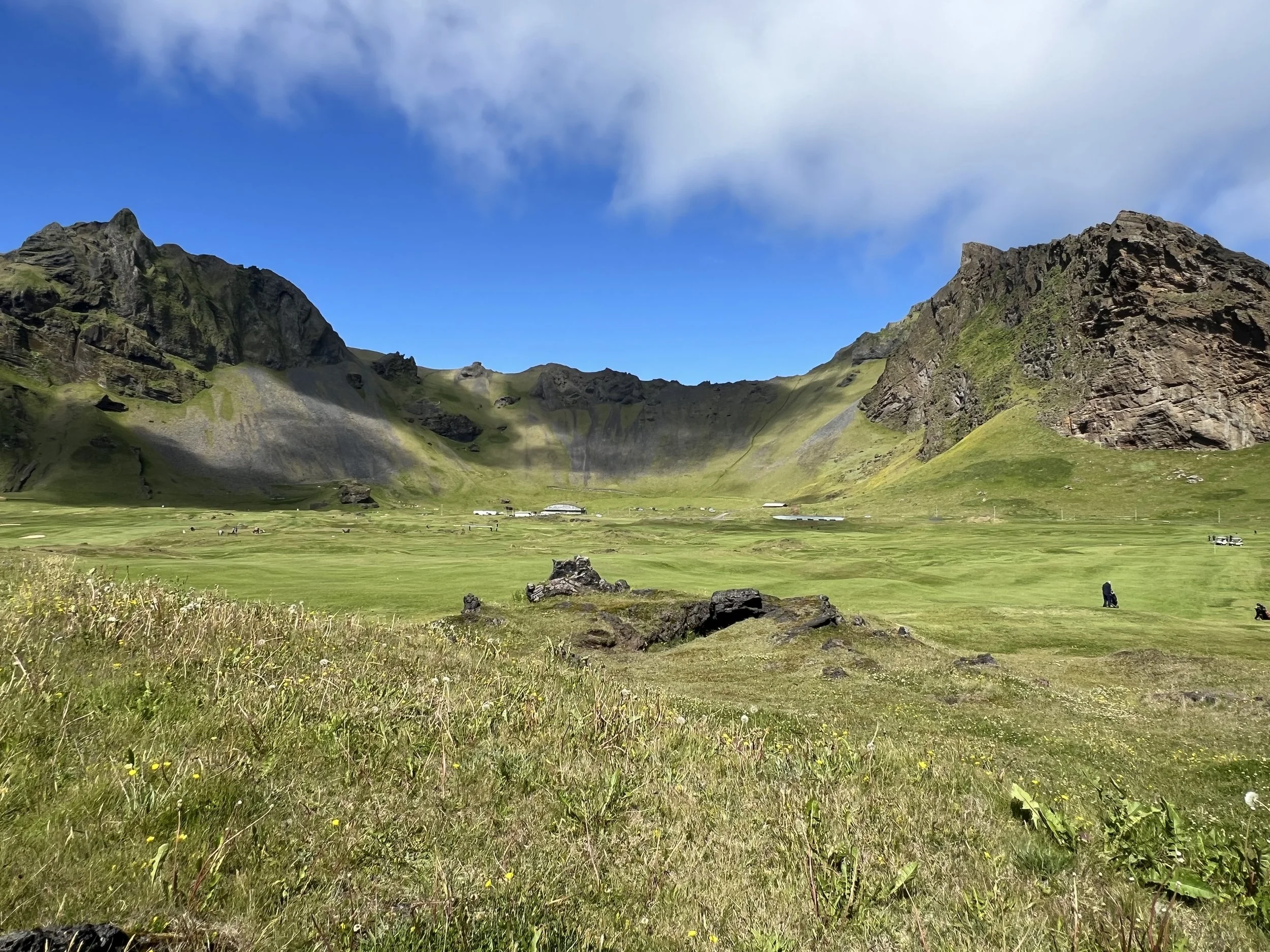
On the island of Heimaey is one of the most iconic golf courses you will ever get to play. Vestmannaeyjar Golf Club (Golfklúbbur Vestmannaeyja) is a stunning 18-hole, par-70 course often ranked among the top 200 in Europe. Set inside an extinct volcano crater with holes bordering the Atlantic Ocean, it offers a dramatic, windy, and unique seaside links experience, famously featuring a signature 17th hole played over the sea.
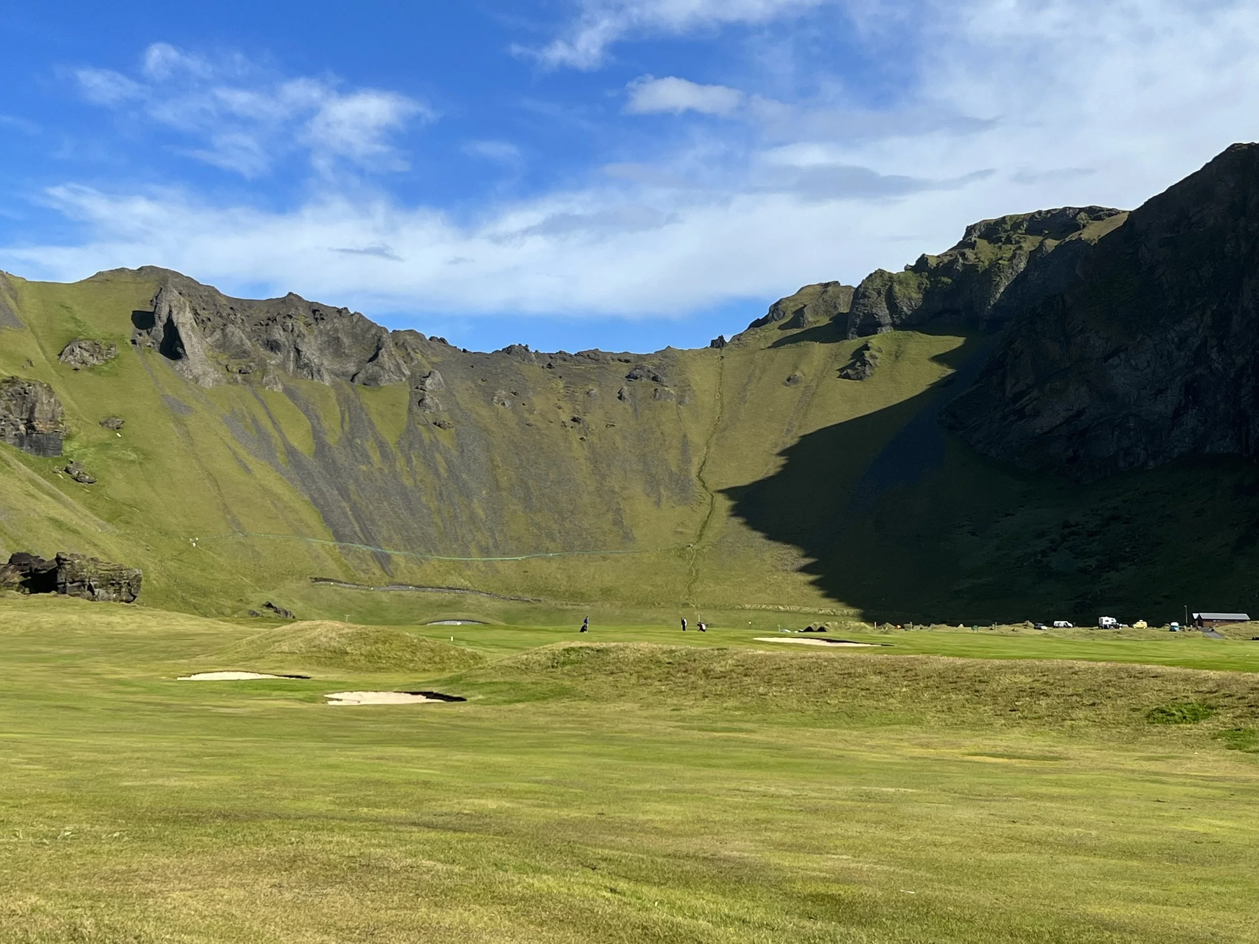
Playing golf in a volcano crater
Given that when I came out to Iceland I had never played golf and never imagined I actually would, I assumed I would never get to experience it first-hand but, having had a few lessons I finally got to play the course with Samuel and Matthew last summer. Samuel and Matthew booked to play a round but I got to play Matthew´s par 3 holes and he took the longer ones. It was such fun and is a lovely (if somewhat confusing) course to play. The first 9 holes are within the volcano crater (Herjólfsdalur), while the back 9 are by the ocean.

Some shots of the course - beautiful in both good and not so good weather!
Three of the Herjólfsdalur holes are the original holes and the oldest golf holes in Iceland which is quite cool. Because the layout is so tight, set as it is in a very limited space, it is perfectly possible to tee off on one hole and find you´ve sunk the putt on a completely different hole! We only got it wrong once and had a thoroughly enjoyable time playing what is very probably Iceland´s most famous course. I mean, there can´t be that many courses where you can take a few steps off the fairway and see nesting puffins, kittiwakes and guillemots? Or tee off, facing the famous elephant rock? And the experience of hitting off the 17th tee, across the ocean swirling around the rocks below, to land beyond the lava on the other side? Although it must be said, I have not yet managed this feat. Knowing I cannot hit that far, I just had a go with a couple of the practice balls, just to say I´d played off the 17th. My golfballs are both somewhere at the bottom of the sea needless to say. Samuel on the other hand, aced it!
This is the section of ocean and lava that you have to tackle on the 17th. The tee is off to the right and the green to the left of this photo
There are many more interesting and exciting things to do in Vestmannaeyjar, such as ATV tours up the volcano, which a friend has done and said was great fun, but I haven´t tried yet. There is also the climb up Heimaklettur (Home Rock) if you are good with heights – Heimaklettur is the highest point of Heimaey, higher even than the two volcanoes. However, not only is it high, but parts of it are so steep that you have to climb a ladder set against the vertical cliff face! Not for me I think…. You can even try Sprangan for yourself, which I also do not intend to ever do!
The island of Heimaey is tiny, you can walk right round it quite easily, but there is so much there that I have found myself visiting again and again. It is one of those places that just draws you back….